Back to the future

IMG_1327

February 14, 2015 — I’m packing up and headed for some training in the Great Smoky Mountains National Park.  The Appalachian Trail Conservancy (ATC) has a base camp there used for training year round and for trail crews in the summer.

I’ll be joining a group of ridgerunners.  Ridgerunners patrol in season the Appalachian Trail (AT) from beginning to end.  The onset of thru hiking season is just around the corner,  and it’s time to get ready.

My role is to test the use of volunteers to augment the paid seasonal staff.  The difference is that I’ll be there only for the month of March.  Everyone else is there for the duration of hiking season – until autumn.

The need for the test is that AT (and other trails) is expected to see a large increase next year in thru hike attempts in response to the movies “Wild” in theaters now, and “A Walk in the Woods” which will be in theaters before summer’s end.

ATHikers

Historical data establishes a direct correlation between increases in thru hike attempts and popular mass media about hiking or the AT.  Books, television, videos have done it every time.  Now we have Hollywood to help drive up the numbers next year.

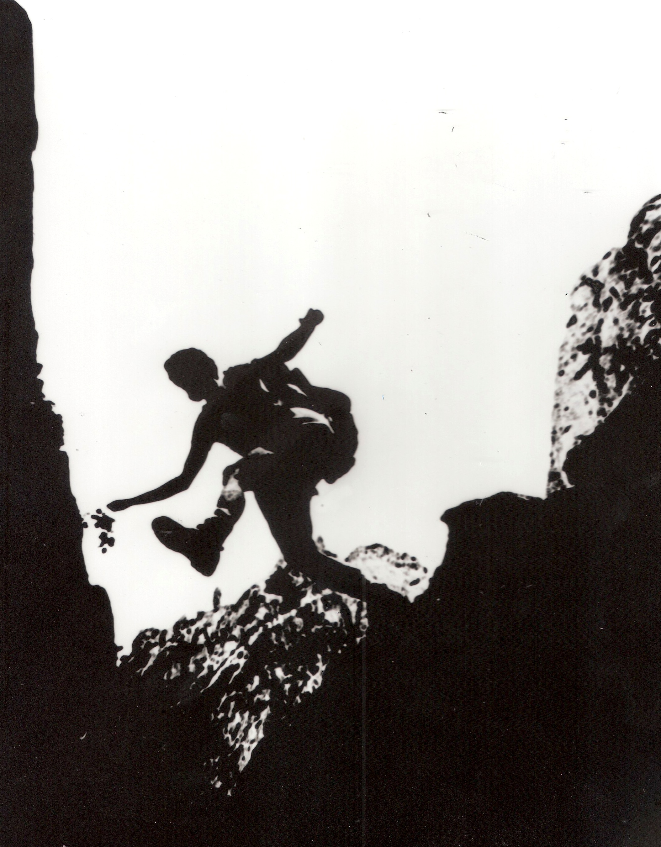
My patrol area is the AT’s 78 miles in Georgia.  We walk five days and spend four nights on the trail.  The sixth day is off.  Of interest, we hike southbound (SOBO) for the purpose of meeting as many thru hikers as possible.  Once we reach Springer Mountain, the Georgia Appalachian Trail Club shuttles us back north to do it all again.

Among our duties is to help hikers as we can, educate them on Leave No Trace™ principles and trail etiquette, pick up litter, do minor trail repairs, and report issues we cannot handle.  These hikes are not about miles.  They’re about the smiles.

The forecast isn’t friendly, at least for next week.  It’s going to be colder than a well digger’s backside in the Smoky’s.  So much so that we’ve been told that we’ll be spending our nights at the basecamp and none sleeping outside. Yea!  No sense practicing being miserable.

The weather in Georgia will probably whip back and forth between ugly and nice with huge improvements toward the end of March.  Still, the southern Appalachians are high enough that snow can fall into April, even when the temperatures in Atlanta and points south are cooking.

IMG_1236IMG_1196

I’m looking forward to some former stomping grounds.  Dick’s Creek Gap is just short of the North Carolina border and the northern edge of the patrol area.  Blood Mountain is in the center of the sector.  It’s got some interesting native American history with some ornery bear activity on the side.

I plan to blog daily, but publish them as every fifth or sixth day as time permits just like I did on my thru hike.  So stay tuned.  If anyone has read Bill Bryson’s “A Walk in the Woods, you know this could be interesting.

Went for a walk on a winter’s day

IMG_1976_2

Compton Peak

Appalachian Trail, Shenandoah National Park (SNP), Compton Peak to Jenkins Gap, Saturday February 7, 2015 —  Each inch of the Appalachian Trail has a human who is responsible for its upkeep.  These folks are called overseers.  Stewards would be more like it.

Overseers remove blown down trees, branches, clean and repair erosion control structures like check dams and waterbars, build new ones as needed, cut back vegetation that may harbor ticks and pick up trash when necessary.

As luck would have it, yours truly is about to become responsible for one mile of the Appalachian Trail from Jenkins Gap to the top of Compton Peak (SNP north district).  That’s AT northbound miles 957.4 to 958.7.  I’m about to become a proud papa.

This is a handsome section of trail if I do say so myself.  From the Jenkins Gap parking lot, it’s optically flat for about a half mile.  This part has been burned over in the past. I’m going to have to learn more about the fire.  Consequently it is infested with lots of vines and thorns. These will require a lot of attention.

The second half begins with a nice flight of stone steps leading to a sluice a bunch of us built two years ago.  The Sluice keeps water from a healthy spring from washing out the trail.  The grade to the top is gentle by any standard.  The treadway throughout has a minimal number of rocks.  Yea!  This isn’t Pennsylvania, you know.

IMG_2002

The trail section ends on top of Compton peak.

A blue blaze trail crosses the AT on Compton Peak leading west to a nice overlook and east to a columnar basalt formation which is one of the few on the east coast.  Eighteen months ago we built 68 stone steps to help make the trail to the basalt formation more passable and to help control erosion.  Judging from the tracks in the snow, it’s popular year round.

IMG_1999IMG_1998

The primary reason for building the steps to the basalt formation was a spring that washed out the trail.  Looks like we’ve got more to learn about water management.

IMG_1995

Columnar basalt.

The day was pleasant.  The temps hovered around 32F with zero wind.  The sun was mostly cloaked by heavy lead-colored clouds.

Without overseers, trails would quickly become impassible no matter whether they are in a state or local parks or one of the big ones in the national trail system.

IMG_1979IMG_1980_2

Before and after.

IMG_1991 IMG_1992

In total there were a even dozen obstructions that had to be removed.

IMG_1985_2

Jenkins Gap.  End of the line.

Let’s go hiking

A few folks have asked me to continue hiking adventure stories.  There are a few real adventures in the work, but in the meantime, here’s what a friend and I were up to this weekend as posted on “Life at two miles per hour.”

Winter Test Drive

IMG_1845

Shenandoah National Park, Appalachian Trail NOBO miles 917.2 to 937.2 (20 miles), January 19, 2015 —  Just like a new car, it’s best to test drive hiking and camping in the winter before buying in completely.  So it was with my friend and trail crew colleague.  She knows her trail craft and is quite comfortable in the woods, but she wanted winter experience.  She’s hoping to thru hike the AT in the future and knows that partying in the cold and snow is almost an automatic on an AT thru hike.  Unlike most guys who would not admit it, she embraces her desire to learn with gusto.

IMG_1842

Denise

So, off we went this weekend on a 20-mile, three day/two overnight, trip along Shenandoah’s most scenic vistas and popular places including Hawksbill (the highest peak in the park), Big Meadows, Rock Springs, Skyland, Stony Man, the Pinacles and Mary’s Rock.

Though the sun smiled upon us most of the time, the temps averaged in the 20s with a biting wind entering stage right and left at cheek chapping intervals. The objective was not to cover ground.  It was to live in the winter weather for the better part of three days and two nights and see what we could learn.

IMG_1844

So off we went… Enjoying the winter wonderland.

IMG_1857

The first day’s walk terminated at Rock Springs Hut.  I stayed there on my thru hike last year.  It’s setting features a gorgeous view through the trees in front of a nearby cabin owned by the Potomac Appalachian Trail club.

IMG_1854

Rock Springs Cabin

Four adult Scout leaders were using it – getting away from the boys for a weekend.

IMG_1860 IMG_1863

After camp chores at the shelter, we went down to the cabin to snap some pics.

On the Appalachian Trail, shelters are called “huts” in Shenandoah and “lean-toos” in Maine.

IMG_1849 IMG_1852

Would you believe it was cold outside?

IMG_1853 IMG_1855

The view from the cabin.

IMG_1861

Sunset behind the privy.

Overnight the wind snarled with gusto, but the dawn air was so still you could hear yourself change your mind!  We popped up, packed up, and after a quick meal of coffee and oatmeal, made a quick giddy up.  No sense wasting time when it’s temperature is singing bass notes toward the low end of the register.  Movement = warmth!

The scenery during the second day was worthy of being memorialized by the likes of Winslow Homer.

IMG_1909 IMG_1907

Same scene.  Different vantage points.

IMG_1869 IMG_1870 IMG_1871 IMG_1873 IMG_1877 IMG_1902 IMG_1903

Winter is nature stripped down to its birthday suit.  Not much to hide.

IMG_1913

Birds Nest 3, our final shelter is a party spot and not the most hospitable place.  The fireplace doesn’t do much good in a three sided enclosure.  The wind howled all night and occasionally spit enough granular snow to remind us who was boss.

IMG_1915

The morning made for a quick get-away back to our cars.

All in all, a weekend marked by challenge and success.

Majestic Maine

Little Bigalow Lean-to, ME, AT NOBO mile 2014.4, Wednesday July 23, 2014 — The Bigalow peaks are in the record books. That’s not to say it’s all easy from here. It’s not, but the long hard slogging climbs are done, all but one – Katahdin itself.

The majesty of Maine remains on display. From the endless horizon to lovely lakes; from monster boulders to rocky trail, this state is special and stands out among the other 13 through which the trail transits.

This rugged country is especially challenging to the maintenance crews – volunteers one and all. The hard rock safety installations and endless miles of bog bridging could not be in place without incredible dedication. Some of these folks have to hike several days just to reach the area they need to work. Did I mention how heavy their tools are? I’m in awe of what they do and have done.

The Bigalows are special. As I cleared Avery peak, I wanted to linger, but thunder rolled in the distance pushing me to get past the final peak, Little Bigalow Mountain, before Thor could fry me with one of his missiles.

I barely made it off Little Bigalow’s slab rock top when someone up there turned on a remarkably cold shower. The motivational zig zag mood lighting spurred the pace just a little.

I arrived at the lean-to feeling like a wet puppy, but I was in good company. At the moment, we’re waiting for more drown rats to float in before someone throws the dark switch to mark the official end of the day.

Tomorrow the trail promises to be relatively flat. I’m planning to dash the 17 miles to Harrison’s Pearce Pond Camp which is noted for it’s massive breakfast. Stay tuned to see if I make it.

20140725-154527-56727737.jpg
A woman simply disappeared without a trace on the trail last year. The area isn’t difficult or dangerous. Sounds fishy to me.

20140725-154733-56853046.jpg

20140725-154918-56958007.jpg

20140725-155238-57158203.jpg

20140725-155520-57320826.jpg
No bridges in Maine. Bull.


Tonight’s campsite.

20140725-160539-57939026.jpg

20140725-160808-58088467.jpg
Maine worries more about squirrels than bears! Not a good message for southbounders who are headed dead on into bear country.

20140725-161123-58283201.jpg

20140725-161246-58366203.jpg

20140725-161343-58423943.jpg

20140725-161448-58488625.jpg
Old fire tower.

20140725-161616-58576402.jpg

20140725-161731-58651851.jpg

20140725-161838-58718519.jpg

20140725-161945-58785844.jpg

20140725-162041-58841342.jpg
Hikes off trail for water. Passed through this keyhole to get some.


Entrance.

20140725-162341-59021642.jpg
Liquid sunshine!

There’s good news tonight!

Sorry this one is out of sequence. Have I mentioned that I don’t like the WordPress ap anymore …

Horns Pond Lean-to, ME, AT NOBO mile 2002.2, Tuesday July 22, 2014 — Gabriel Heatter was a noteable radio newscaster in his day. His signature sign on was “There’s good news tonight.” That’s what I’ve got.

More than 2,000 miles have been recorded on the ledger. Only 183 left to go. Of course there are the Bigalows where I am now and a whole lot more that must be endured before the final climb up Maine’s feature mountain.

Today’s hiking was beyond strenuous. I was camped half way up south Crocker Mountain. As luck would have it, there are two of the steep little SOBs right in a row. They’re followed by a steep descent where a paved highway leads to the village of Straton which I by-passed.

Then comes one of the most beautiful ups yet. The trail scrambles between talus rock falls and monster boulder fields. It could have been a “Lord of the Rings” movie set. Bilbo my man, me thinks we might be in mordor.

I also was about close to exhaustion when I stumbled into the lean-to. It was hot today and the water wasn’t spaced out well. After quaffing some pond water, and following a calorie laden dinner – chicken with cheese potatoes – I am both stuffed and refreshed. The knees feel great too!

It’s difficult to describe the attraction engendered by Maine’s rugged and strenuous hiking. The isolation is everything which most of us were hoping this hike would be. I mean I haven’t heard a Harley’s obnoxious exhaust from the trail in Maine yet!!! Most everywhere else, they keep campers awake at night. Not here.

Tomorrow features a couple of leg burning climbs, but it’s a relatively short day with scattered thunderstorms forecast in the afternoon. I has wanted to hike 17 miles to a shelter from which I’d get a running shot at the Kennebec ferry and my food drop in Caratunk, but considering the weather, I’ll split the days.

20140725-163657-59817507.jpg

20140725-163728-59848019.jpg
Someone has a sense of humor.

20140725-163823-59903623.jpg

Manhattan Transfer

Wiley Shelter, N.Y., AT NOBO mile 1,450.5, Monday May 19, 2014 — The AT has its own train station, yup. Well, it’s a stop, not exactly a station, but what the hey, the train to Manhattan does stop right exactly on the AT.

According to the log books, a lot of folks take the train out to go hiking on the AT. A lot of hikers who’ve never seen the city ride in to see what NYC is all about. Pretty good deal, I’d say.

It was in the low 40s again this morning. Tomorrow we’ll be in infamous Kent, CT where my summer gear awaits. I’m thinking of bouncing it ahead to Mass because I have my doubts about just how warm my Army poncho liner really is.

One idea I’ve come up with is to curate the trail. The educational opportunities are unlimited. This trail passes through 12 of the 13 original colonies plus West Virginia. Think of the history both chronological and natural. It wouldn’t be quick or easy, but it could be accomplished over time.

For example, today we hiked past Nuclear Lake. Every year hikers muse in their blogs about how the lake got its name and what nearby companies GE/ATT/IBM might have buried there. Hummmmm… Nothing in Wikipedia.

Other than that, it was another great day.

20140519-193948-70788698.jpg

20140519-193941-70781709.jpg

20140519-193943-70783702.jpg

20140519-193940-70780137.jpg

20140519-194351-71031291.jpg

Scrambled Eggs and Trail candy for Breakfast.

The morning opened crisp and bright following the best night’s sleep I’ve had on the trail from 8 pm to 4 :30 am nonstop.

The day dawned seven degrees and sunny. With more than 18 miles on my dance card and wobbly trail legs, I wanted an early start. I was off promptly at seven o’clock, as soon as it was light enough to see clearly.

The trail itself was in great condition and the snow soon disappeared. Within an hour I stumbled into one of the most precious chunks of trail candy on the AT.

Lindamood School is part of the Virginia Pioneer museum. The school was built in 1894 and functioned as a one room, one teacher grades 1 thru 7 school until 1937. It has been preserved in its original condition. Best of all, hikers are welcome to enter – the building is unlocked – and sign the hiker register.

Soon after that the trail runs through Atkins, Va. where the AT slides under I-81 to the west. It’s a fading truck stop with a brick factory as its sole economic engine. Magic happens there anyway.

The hiker-friendly and very nostalgic Barn restaurant is right in the trail. The minute you cross the threshold you’re in a small country eatery staffed with friendly waitresses who call everybody “Hon.” The locals wave a friendly greeting and the scrambles eggs and grits are just like mom’s. Not a bad start to the day.

As the day pressed on, a good hiking rhythm developed and the miles clicked by, many of them through pastures dotted with fresh cow pies.

This is country is covered by farms that have seen better days.

The last mountain was hard. Unfortunately I was a bit dehydrated which made it worse. The two-mile climb, though not long or particularly steep featured a ton of steps. In my condition each was a mountain in and of itself. My quads were rubbery as I struggled to lift my body over each one. I made it to Knot Maul Shelter just before dark.

Along the way I’d also managed a 1,500 foot climb just prior to the last mountain. I was feeling good about my performance. Did I mention that tomorrow starts with a 2,000 foot climb. 🙁

All in all a good day, especially before breakfast.

20140306-194109.jpg

20140306-195106.jpg

20140306-200445.jpg

20140306-201504.jpg

Dumbo’s Feather

Image

I am thru-hiking the AT this year with fond memories of my late friend Bob Schwartz. 

In the mid-1970s, when we were young, hard-bodied and living in Colorado Springs, Bob was my favorite hiking, climbing, and biking partner.  We would hit the Rocky Mountain high country as often as our lives and wives would allow. 

Together we summited “fourteeners” in winter and summer, bouldered and swam through the 1,800-foot-deep Black Canyon of the Gunnison River, rode centuries through the rolling plains around C-Springs, and contemplated the cosmos as we camped at starry-eyed altitudes. 

Image

Bob in the Black Canyon of the Gunnison River, Colorado

Bob loved New Hampshire’s White Mountains.  Walking there in his footsteps there will be the most cherished part of this experience. 

Bob was a native New Yorker (Brooklyn).  Through his eyes (and accent) I learned my way around the city long before I ever set foot there.  His quintessentially Jewish sense of humor and piercing intellect were extraordinary.

Bob graduated Phi Beta Kappa from Yale in only three years on his way to becoming a distinguished physicist, NASA scientist and university professor.  During our journeys we often camped above tree line where the deep velvet sky is sequined in stars.  His education was my good fortune because, ever the professor, he never missed an opportunity to expand my mind and share his appreciation for the cosmos.

Bob tragically died of Creutzfeldt-Jacob disease (CJD) in 1980.  At the time, his doctors believed he might have contracted this brain-destroying disease while doing post-doc work at Cambridge University.  Bovine spongiform encephalopathy (mad cow) was present in the UK then, and researchers believed that CJD could be contracted by eating contaminated beef. 

The irony of a mind-robbing disease destroying a brilliant intellect remains heart-breaking to this day.

After he died, Bob’s wife Mary wanted me to have his climbing and camping gear.  In Bob’s memory, I will carry one of his carabineers.

How would I know the carabineer was Bob’s?  Climbers mark their equipment because during climbs it often gets co-mingled with hardware belonging to others.  Since Schwartz sounds like schwarz – German for the color black – Bob marked his gear with black electrical tape.  Duh!

If Bob were part of this hike, and believe me he would have jumped right on it, we would literally fly like Disney pachyderms.  ‘Quit’ and ‘impossible’ were not in his vocabulary, although he spelled PRUDENCE in all caps. 

Once while ascending the south route of Colorado’s Crestone Needle (14,197ft.) in February, my toes were suffering from frost nip on their way to something worse.  We descended to our tent pitched on a saddle below, warmed my foot and changed into dry socks.  I was thinking zero and a very early dinner, but Bob pointed his mittened hand upward, and back up we went to keep our appointment with the blustery summit.

My friend, we will be united once more, especially on those magical midnights when stardust rains from the sky.  Your carabineer will serve as a talisman inspiring me to press onward relentlessly and always.  It will remind me to be courageous, to challenge my imagination and to encourage my mind to travel far beyond what little I can actually see. 

I am so thankful to have Mary’s bequest.  It reminds me that life and good health should never be wasted.  You have my solemn promise to give this journey every ounce of energy, fortitude and kindness to others that I can muster.

Just as Dumbo clutched his feather and soared, I hope having Bob’s ‘beaner’ along for the ride will do the same for me.  BTW, It’s not useless weight.  In addition to its function as totem, it moonlights by clipping my micro spikes to my pack by day and as my bear bag hanger by night.

Sisu – Making tracks

 “Waste no more time arguing about what a good man should be.  Be one.”  Marcus Aurelius

(A version of this essay was previously posted on Trail Journals.)