The magic ratio rules the day

Image

Numbers tend to govern our lives, even deep in the woods while hiking the Appalachian Trail.  Obviously there was too much time on my hands, or I wouldn’t have started thinking about them.

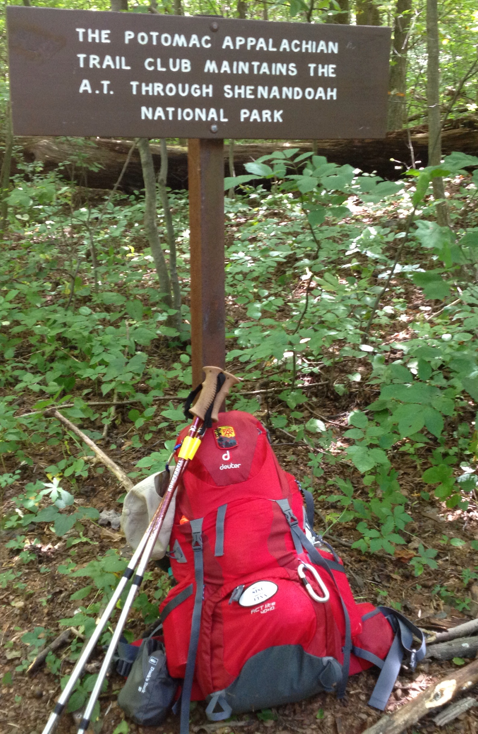
The most apparent use of the numbers 2 x 6 is the White Blaze.  Two inches by six inches, there’s no navigation without them.  The white blazes are the central focus of every day.  Gotta have ’em and have to find them.

Unfortunately, it seems to be universal that there aren’t enough of them.  The blazing is very inconsistent throughout the trail.  I can’t tell you how many times I and others have spent trying to figure out directional changes or if we were on the correct route when another trail overlaps with the AT.  Let’s not talk about twilight, night or certain sun angles.  Is there a white pain shortage?

Blazing is the responsibility of volunteer trail supervisors – folks who accept responsibility for routine maintenance of specific sections of the trail.  Unlike thru hikers, they are familiar with their territory.  They don’t arrive clueless, tired, hungry, thirsty, with the sun in their eyes, or in the dark of night. 

Once my thru hike is over, I’m scheduled to become a trail supervisor in Shenandoah National Park.  Trust me, I’ll walk my trail section both directions, at all hours of the day and night and try to put myself in the shoes of unfamiliar hikers trying to find their way.

The two by six magic ratio also applies to shelter space.  That’s about what you get in a crowded shelter.  Measure your inflated air mattress.  It’s close.

Someone asked me about my daily routine. It is dominated by 2 x 6.  Beyond white blaze navigation and sleeping space, a space two feet by six feet is the area upon which I concentrate while walking. 

On the AT, people rave about the views.  They are the exception.  Most of the time is spend head down, surveilling a moving chunk of trail two feet wide and about six feet long.  The primary objective is to avoid falling or injury.

There’s a lot to look for depending on the time of year.  Consider rocks – loose and otherwise, slippery exposed roots, leaf litter, holes, snakes, giant piles of bear scat, terrapins, steps, blow downs, ice, mud, and other hazards.  Hikers see the AT in rolling 2 x 6 chunks whether they want to or not.

In describing my day, I don’t know whether to start in the morning or evening.  Each time of day is a bookend and a logical beginning or an end.  Weather and the amount of daylight are big schedule drivers, making this time of year roughly equivalent to hiking in early March.

Normally my first wake up is at 0430.  Naturally, it’s too cold and too early to get up.  I usually doze until 0530 or 0600.  Definitely by six I’m up and moving.  First thing I pack my gear – tent, sleeping bag, air mattress etc.  The last item in the pack is my down jacket.

I have both a system and a fixed routine that never varies.  If you’re familiar with Six Sigma, you’ll automatically understand why.  Consistently repeating a strict routine and having a highly organized system for packing prevents mistakes like leaving stuff behind.  The added benefit is that gear is organized in order of priority of use and grouped by type.  For example Rain pants, jacket, hat, and pack cover are in the middle outside pocket where I can get at them RIGHT NOW if need be..  Gaiters are in one side pocket.  The opposite one has water and three light weight clothing items to be added as layers when I stop or get cold.  I also made a water holster out of a net bag.

I’ve given up cooking hot breakfast coffee, cocoa, grits or oatmeal.  When it’s very cold, I need to get moving to generate heat.  Consequently I chuck three or four granola bars, Cliff bars, snickers, Builder Bars or their equivalent into a side pouch and get moving by 0700 which recently has been first nautical twilight. 

This I borrowed from my Army days.  I normally walk 20 – 40 minutes before stopping to adjust what I’m wearing, eat, drink and settle in for the day.  By then I am warmed up, know what to wear for the day (generally much less than most would think), and have a feel for the trail.  This also is when I double check my trail guide to confirm my hiking plan for the day.

As the day unfolds, I tend to snack around 10, 2 and 4 (remember the old Dr. Pepper commercials?).  I stop to take photos whenever the opportunity presents itself, and sometimes will spend 20 minutes on a sunny lunch.  Otherwise I’m motoring along. 

Almost from the outset, I could average 12 miles per day.  More recently that’s been upped to between 15 and 18.  I’ve done a few 20s, but really have not needed them and don’t plan to make them a habit due to the cumulative wear and tear they seem to generate on my body.

I try to reach my camp – stealth site or shelter – by 5 p.m.  That gives me an hour to settle in and eat.  Can’t wait for the days to lengthen so I can actually hike much later or earlier if desired.

First thing I get water and figure out how to hang my food and throw the rope if necessary.  Then, I dawn my light weight layers and down clothing to conserve heat. Following that step, I set up my tent and bedding so the down has a chance to loft.  I cook – the usual:  Generally Mountain House dehydrated meals, Knorr pasta sides, or Ramen noodles.  I normally add spices and make decaffeinated tea or coffee.  After I’m done eating, I put everything away and hang my food bag with my cooking pot and trash bag inside.  

While eating, I study my Awol Guide and plan the next day paying particular attention to the location of water sources, the trail profile and alternate places to camp depending where I am between 2 and 3 p.m.

Then it’s time for bed.  The night I slept at Tri Corner Knob shelter in GSMMP, I reached the shelter around 4:45 p.m., got water and followed my routine.  By the time dinner was done, it was pitch dark.  I slid into my sleeping bag and checked my watch:  it was 6:15! 

“Whoa!”  I thought.  I quietly enjoyed listening to the wind and woods for a couple of hours before breaking out my iPod nano which I use mostly to listen to pod casts or vintage radio dramas at night.  I generally sleep hard for about four hours, then cat nap until around 0430 when the daily routine begins all over again.

Exciting.  Not really.  It’s all about ratios, time and daylight over and over again. 

The fun comes from what you serendipitously see, hear and find, and from the people with whom you can share your experience.


Gizmos, Gadgets and Acquired Knowledge

Image

When you’re hiking day in and day out, your mind sometimes drifts to the whimsical.  Other times it’s strictly focused on not tripping, the next drinkable water or whether or not you can make the next shelter before dark.  Unfortunately, there’s much more of the later. 

The all too familiar scenario became: 3 p.m.  Dark at six.  Six to eight miles to go.  All up hill. 🙁 

Along the way, I had an idea.  Water weighs a pound per pint. In round numbers, that means two liters weigh slightly more than four lbs.  That’s a lot.  Fortunately, I learned to carry only a single liter when I got word that the water was good up ahead.

Still, I have a challenge for all my scientist friends at Georgia Tech.  What you geniuses need to invent is dehydrated water.  You know, open the bottle and just add air.  Air has the essential ingredients –  hydrogen and oxygen.  Certainly, someone could figure it out.  Sure would help a bunch of tired hikers!  Every hiker to whom I mentioned was certain that the scientist who invents dehydrated water would be canonized for sainthood!!!

As for the rest of the gizmos and gadgets, there’s good news and bad.  First, I used everything I brought in my pack from sewing kit to the Kindle.  Obviously, not everything in the first aid kit was used, but parts of it were.  The Kindle didn’t get used enough, so it’s stays home, as much because of the cold weather’s effect on batteries as anything else.

Lithium batteries are terrible in cold weather.  No way around that.  Even when kept in my front pocket, my phone/camera power level would dive from 100 percent to zero after a couple of minutes of exposure on cold days.  (It was in airplane mode.)  The same goes for spare storage batteries.

The best I could do was store the phone close to my body and the spare batteries deep within my clothing bag.  At night I put the phone and/or iPod under one armpit after diving into my sleeping bag, and the storage batteries under the other.  Once everything warmed, I could recharge or listen to the media stored within.

Cold is for lovers.  Everything wants to get in bed with you – that is your water bottles, your fuel canister, your electronic devices, extra batteries and your sweaty clothes.  I’ve never felt so loved in my life!

My Salomon GoreTex boots froze on a couple of nights because I had no room for them in my extra skinny light weight sleeping bag.  It wasn’t a big deal.  So long as I had dry socks, my feet were never cold, even in frozen boots.

Sweaty clothes.  Only once did I have to whip off a soaking shirt and replace it at the end of the day.  The polyprop shirts I had wicked dry in a very short time after I stopped hiking.  Usually I just covered my base layer with a couple of loose wind shirts I carry for layers.  Over them, snuggled my down puffy as needed.

I often hiked in a pair of compression tights that I use for running and cross country skiing.  They don’t hold water at all.  Best of all, they provide excellent support for leg muscles and joints.  At the end of the day, slipping my rain pants over them did the trick.  No problem wearing the whole giddy-up to bed.

In an earlier blog, I nominated the ziplock freezer bag to replace the Swiss Army knife as the universal tool.  Subsequently, Tenacious Tape gave its zippered brethren a run for their money. 

Somehow, a mouse got into my pack and ate a hole in the baffle between the lower and upper compartments enroute to building a nest.  My sleeping bag developed a hole on the inside.  Wondered why my tent was full of feathers in the mornings…  A three-seam corner in my tent leaked.  The stuff sack for my tent got a small rip. 

Tenacious Tape (and a little silicon sealer) to the rescue. By NOC I had used nearly a whole role of tape.  I bought two new ones from the outfitter at NOC just to play it safe.  Ladies and gentlemen, this stuff works.  It’s specially formulated to STICK to the light weight nylon used in our equipment.  Keep the AMEX card, I wouldn’t leave home without Tenacious Tape. 

Duct tape.  What’s that?

David “Awol” Miller’s guide is the gold standard.  It’s highly accurate, though not perfect.  I carried the AntiGravity Gear strip maps as a supplement.  Gave up on them quickly. 

The universal challenge with the AWOL Guide is reading the trail profile.  On days the trail looks easy, it’s hard in reality and visa versa.  A lot has to do, not with the trail incline angle, but the surface condition of the trail bed – how rocky, number of steps and boulders, roots, etc.  Just don’t be lulled into a false sense.

A lot of the trail infrastructure listed in the Awol Guide pops up during hiking season; then disappears by the end of April.  That was a tough one to learn.  Shuttlers, hiker rates, and other conveniences haven’t been there in some cases.  Also be advised that those listed in the Guide pay to be there.  (I asked.)  Nothing wrong with that, but caveat emptor. 

Saw evidence of a lot of bear bag hanging disasters in the form of ghostly and mossy derelict food bags tangled way up high. Alternatively, there’s ample evidence of cut ropes decorating prime hanging trees like nylon tinsel.  I’m keeping my fingers crossed.  So far, so good.  Just hang your food, please.

Speaking of food, since I’m cooking exclusively in ziplock bags, I switched my stove from a Pocket Rocket to the small Jet Boil Sol.  It’s incredibly more efficient at boiling water which is all I do.

Lastly, I tented most nights near shelters.  My tent was warmer and easier to keep my “stuff” organized and safe.  Unfortunately, at a shelter in the Smokies, three meals disappeared after I hung my food bag on the bear line.  At the same shelter someone rifled my pack when I was outside cooking and took three twenty dollar bills from deep within. Lesson learned.  I’ve since acquired a wallet that hangs around my neck.  $hit happens. 

On blogging and future plans

20131030-194816.jpg

AT blogs seem to be divisible into two fundamental categories. The travelog and the essay.

The travelog blogs appear to try and chronicle in as much detail each day more or less as the hiker progresses. In 2013 there were several outstanding writers of this genre. My favorite was Linda (Karma) Daly’s blog at http://thumperwalk.com.

The essayists pick topics and explore them. A lot of the travelog detail makes it into these stories, just not in chronological order. Clever Girl was, in my view, handsdown best in this class at http://trailkit.blogspot.com

My blog is a collection of essays. Either my imagination is a failure, or I’m too boring to write a travelog. I’ve spent 36 days hiking the Appalachian Trail since 10:08 a.m. Sept. 24. That’s enough to know that most of the days are pretty much alike. The first time something happens, it’s special. After that it becomes pretty mundane. I can’t make writing about hiking in the rain interesting more than once – if that – unless it turns into an adventure of sorts.

I’m telling you this because I have some readers who may be expecting a travelog. For instance, someone wrote to me correcting my mileage to date. It’s 400.8. What I said in my last blog was that I was writing from Hot Springs, NC. Due to the essay format, I did not say I hiked there. In reality, I got a shuttle from Davenport Gap where I’d stayed at Standing Bear Farm, to Elmer’s Sunnybank Inn in Hot Springs. Hence the missing miles.

I needed the shuttle because my wife was scheduled to pick up me, along with two other hikers who needed to get to the D.C. area, in 36 hours. With sore tendons from having to hike long days to reach certain shelters in the Smokies, I was in no condition to hike 38 miles that quickly. Moreover I was a day behind schedule thanks to the storm that dictated my side trip to Gatlinburg. So, I got a ride and took a zero in a great hiker town to make up the difference.

When I return to the tail, I’ll spend another night at Sanding Bear and start hiking the next morning from Davenport Gap. No way I’m going to miss Max Patch! I’ll also get another night at Elmer’s when I reach Hot Springs. That’s a bonus.

The plan for the hiking through the winter is simple. Since I’m solo, I am acutely aware that I need to be careful of the weather. My wife and I will be paying acute attention to 10-day forecasts with the intention of being off the trail during storms. The accuracy of 10-day forecasting means I’ll be hiking on average from three to seven days out of every 10.

In addition, from this point on, I’ll be trucking my full winter kit complete with snowshoes, microspikes, mittens, balaclava, including down jacket, pants and booties to supplement my sleeping bag. Everything is in dry sacks. The down garments are double bagged.

My winter goal is to reach by the end of March, Waynesboro, VA where I started on Sept. 24. If this is a stormy winter, that may not happen. If not, I’ll dive into the first 2014 hiker bubble that comes along in the spring.

I did hear that there are two men and one woman, each hiking solo, ahead of me. I hope to meet them before the winter is out.

So, family, friends and random readers, that’s the plan. More to come on gizmos and gadgets, the 2:3 ratio, the cost of trips to town, and more.

BFRs. What are they good for?

BFRs. Yup, Big Effing Rocks! What are they good for? In Appalachian Trail maintenance, most everything.

The Hoodlum work crew had another great weekend, our final regular outing until March.

The work group to which I was assigned built two check dams and a water bar on the Pass Mountain trail – a blue blaze trail in Shenandoah National Park.

This video offers a little bit of insight into the work we do and the fun we have doing the work and afterwards.

The water bar we are constructing in the video was much needed to help keep the trail in good hiking condition.

Hikers sometimes wish the trail was in better condition with fewer rocks and less erosion. Rest assured there are a ton of volunteers up and down the full length of the AT working had to keep it in the best condition possible.

If you think the rocks are bad now, imagine the AT without erosion control and other maintenance.

All erosion control structures require building material. Stone is best, but simple swales only require mounds of dirt. Logs, particularly extra hard woods such as Ash are long lasting substitutes when stone isn’t available.

If stone is preferred. Than BFRs are the best you can get.

Rock potentially lasts a lifetime. Moreover, if the stones used are ginormous enough and set deep into the trail tread, the bears have a hard time digging them up to get at the grubs that take up residence underneath. Yup, the bears love to play three card Monte with big rocks. Sometimes they even score a treat.

Chunking BFRs around is hard work with dependent mostly on brute force and ignorance. You really only need one smart person who knows where the rocks should go for best effect. That means I’m pretty much qualified be a rock technician, but not for the engineering jobs.

Erosion control structures on the AT come in a simple variety. Check dams are perpendicular to the trail with the purpose of slowing down the water flow. They should stick up a few inches and require frequently cleaning to ensure sediment doesn’t render them useless.

Water bars are set at a 45 degree angle to the trail direction. Their purpose is to direct water off the trail. Check dams and water bars frequently work in coordination with one another

Parallel drains are canals/ditches that run parallel to the trail tread for some distance until they reach a point where water can be sent away. Sometimes the trail tread is raised and the canals are made of carefully fitted stone.

Steps help prevent erosion or may simply improve the hiking experience by adding safety or by making the trail easier. Stone is preferable and more durable, but logs and compacted dirt or gravel work.

You’ve all seen the ladders and rebar in New England. Those are special cases.

Sometimes dirt swales are dug and the spoil is mounded and compacted to form a check dam or water bar that works fine as long as it lasts.

If you live close to Shenandoah National Park, consider joining the Potomac Appalachian Trail Club and channel your inner 12-year-old. Become a Hoodlum Trail Crew member. It’s fun!

SOBO is the loneliest number

Image

I met a lot of SOBO (Southbound AT hikers) during my recent two week hike on the Appalachian Trail.  But with the exception of the large Millennial flash mob at Pinefield Hut, they were few and far between.

As I met southbounders along the trail, they were eager to talk and enjoy a little company.  We always exchanged the usual trail intel – water sources, was Shenandoah allowing thru hikers to pass through, trail conditions, etc.  Yet beyond that, they all said theirs was a lonely hike.  They just didn’t see that many people.

It was always best to meet up with SOBOs at shelters.  Then we had the time to enjoy each other’s company.  Usually they were by themselves.  On two occasions, other than the flash mob, there were two or three.  At Gravel Springs I ran into a thoughtful young man on a post high school gap year.  Joining us was a PhD student in cultural geography and his Spanish girlfriend from Madrid. 

On that evening and again at breakfast, we had stimulating discussions about books we’d read in common, what America was like in comparison to expectations, and we exchanged a few quips in Spanish.  BTW, the American standout was the abundance and types of wildlife.  Think real black bears in the wild – no bars, no barriers, no zoo.  Very cool to a European.

Mostly I encountered about one SOBO per day, usually a day apart from one another.  I’d always tell them who was ahead of them and how far.  A couple of them said they were trying to catch up with people.  The encounters with hikers whose blogs I’ve followed was especially sweet. 

Southbounders have a certain advantage.  Weather tends to be better, especially once they’re out of New England.  They get to avoid most of the heat, insects and the worst of the cold weather. The shelters and hostels aren’t crowed either.

There’s one thing nobody figured on.  Everybody said the trail magic ended as soon as the last NOBO bubble past them by.  It was like nobody cared anymore.  They were alone.  SOBO and solo.  I was saddened.  They were missing the best parts of the AT experience. 

Sisu – Making tracks.

Stink Bugs + Notebook Odds and Ends

Image

 Avoiding stink bugs at Dick’s Dome Shelter


Some days you get the bears, and some days the bears get you. 

Day nine of my hike was the most difficult.  Hard rocks (Aren’t they all?) punctuated most of the day and I had a lot of miles to log.  A little bit of serendipity want a long way, and on balance, I got is good as I gave.

If you read my blog post on music, you know that I’ve given it a lot of attention.  Three times on day nine, music lifted my spirits and lightened my load. 

The first musical magic was Willy Nelson singing  “A Little Bit of Karma” just as the trail leveled out after a long steep climb.  I muttered a weary thanks to Karma, my 2013 thru hiker friend, for her kindly intervention.  This woman has certain super powers.  Could she be a saint, I wondered?  Then, just as soon as the song finished, the trail turned upward again. 

Not much later, John Denver crooned “Country Roads” just as the blue hills of West Virginia hung on the horizon.  I sang along. After all, West Virginia was destination and it would be “almost heaven” when I got there.

Better yet, a couple of hours later, as I worked my way up Pass Mountain with twilight close behind, Hanna Montana uplifted my stride with “The Climb.”  Music saved the day.

Needless to say, after day nine, my feet ached, but not as much as they might have.  My podiatrist made me special orthotics to protect against plantar fasciitis.  They are worth the investment.  They did need an adjustment to widen the heel cup on the left one.  Once it’s back from the lab, I’ll be back agitating AT gravel. 

The first thing I heard a southbounder complained about was stink bugs.  This surprised me because I didn’t recall anyone complaining about them on Trail Journals.  The further north I got, the more prevalent these nosy pests became. 

When I reached the Tom Floyd shelter at mid day, hundreds of them had taken up residence.  A day later I set my tent up inside Dick’s Dome so I could get a peaceful night’s sleep.  Precautions aside, a couple of dead ones fell out of my pack as I emptied it back home.  I’ve got a bad feeling about these guys fellow fourteeners.

Electronics and storage batteries became a challenge.  My 10.5 amp hour storage battery failed for the second time.  I had to heavily ration my phone and iPod batteries.  I did get to charge them at waysides and Bear’s Den.  However, I wasn’t able to blog or take many photos with my phone, or listen to my iPod except for an hour or two at night. I’m working on the fix.

Phone battery hell.  Temps around 40 on the first few mornings played hell with my phone battery, cutting the charge from 50 percent to zero.  I was surprised at this level of sensitivity to cold.  All I had to do was warm it back up, but figuring out how to keep it next to my body in the much colder temps next spring is a must.  Batteries like to be comfortable.

Last, my wife and I developed a system for staying in touch, not knowing how reliable phone service or email might be.  At each opportunity I texted her the AWOL guide NOBO mileage number as I passed landmarks and had phone service.  A simple 968.3 was easier to get through on one bar than something more complicated.  While I couldn’t always text my final daily location, we never went more that 12 hours being out of touch.

The New Fall Lineup

Image

The indicators are all there.  School has started.  The first college football games play this weekend.  The automobile companies are ready to unveil next year’s models.  The TV networks are unwrapping their new fall lineups.  It’s fall.  My favorite time of the year.

As Labor Day approaches the anticipation of autumn excites the senses.  The pending ascendance of nutmeg as top spice in the kitchen helps complete the fashion shift from polo shirts to polar fleece.  By the time the frost is on the punkin’, snow can’t be far behind if you live far enough north.

If fall is a-comin’ then my mid-February Appalachian Trail start date is just around the corner.  Time to focus on the task at hand and lay down some boot tracks.

In any sport, cross training helps improve performance.  But, no matter how much cross training you do, you still have to get the reps in for the sport itself.  Football players lift weights, but they also block and tackle, baseball players hit, catch and throw and runners run.  It follows that hikers should hike.

The trail is pulling me out of my comfortable rut and telling me to start putting one foot in front of the other, get funky and stress test the shelter, sleep, food, and clothing systems that will be used during my thru hike.  Only a long trek can produce the realistic conditions needed.

The first item on the fall dance card is a joint National Park Service/Potomac Appalachian Trail Club two-day advanced trail maintenance workshop September 21 -22.

We’re scheduled to build erosion control structures with big rocks.  Think Triassic tinker toys, building blocks and Lincoln logs all rolled into one giant play set.

This stuff is fun, especially the part where we’ll be car camping at Mathews Arm Campground in Shenandoah National Park.  We get to bring a camp chair and coolers! They’ve got showers!! They’re even cooking the food for us!!!

I wonder if the cooks could just follow the class of ‘14 up the trail?   We could all chip in…

A couple of days after the workshop, it’ll be happy trails for for me on the 160 miles of AT from Waynesboro, Virginia to Harpers Ferry. That’s enough miles to find out what needs fixing. 

It has another advantage.  It simulates the longest leg without resupply that I’m planning in the spring.  That stretch is from Fontana Village, NC to Hot Springs, NC.  I’m not particularly high on the options in between, so a simple by pass strategy seems reasonable caveated by a severe weather opt out proviso.

Here’s where it gets personal.  This particular test hike is not happening by accident.  It will determine whether my body will stand up physically to a thru hike.  With all the weight training and running, you’d think it would be a cinch.  Let me clue you in on a secret.  It’s not even close.

Six years ago I severely injured my right ankle.  The injury includes the effects of tibial nerve damage that may not withstand the continuous pounding and dynamic stresses that long distance hiking generates over time.  If the outcome is going to be negative, it will be unambiguous and show up before the end of this little jaunt.  My thru hike could be over before it even begins.

If that isn’t enough, a chronic running injury called piriformis syndrome adopted me several years ago.  When the piriformis muscle gets irritated, it is literally a pain I the butt that hurts like hell. 

Of course the hurt has a bonus effect.  The swelling irritates the sciatic nerve.  And that my friends is a joy to experience, not to mention a potential show stopper! Both injuries are in the same leg. Has anyone ever hiked this thing on one leg?

 I’m actually shocked that my right leg and foot haven’t filed a class action law suit for abuse. 

The effects of these injuries can be moderated by systematic stretching, religiously limiting miles, and frequent rest.  But in spite of everything, piriformis misbehaves on its own schedule.  Moreover, the neuropathy in my right foot attended the same reform school and they’re both frequent recidivists. 

Drama aside, there’s plenty of optimism.  After all, I’ve made it through a year’s worth of heavy duty trail maintenance without problem.  My intermittent hikes with a full pack have gone well.  We just need more a more realistic test before actually reporting for duty in Georgia.

Triassic rocks and a little long haul truckin’ – a couple of nice shows for the fall schedule wouldn’t you say?  Ah, but it gets even better.   Get this.

Following a successful hike to Harpers Ferry, it’s immediately home to refit and head out to rendezvous with a member of the class of ’13 who flipped and is now southbound for Harpers Ferry on a Thanksgiving deadline.  I get to observe a real lab rat performing the act itself.

The social benefits of having a compatible hiking partner aside, a medicinal traipse through the Pennsylvania rocks will notch up the difficulty factor enough to be an absolute validation of my body’s ability to perform over six months.  Can’t wait.

What comes after Thanksgiving?

Last December I saw someone who gave me a great idea.  This guy was decked out in REI’s finest while hiking with a ginormous pack on the Capitol Crescent Trail – an old street car line that’s now a nice walking path from Silver Spring, Maryland to Georgetown, D.C.  Only later did I realize that he was training for the AT. 

Thanks to the anonymous hiker, I’ll devote several hours each day, regardless of weather, to following his footsteps while wearing a full pack until it’s time to do an about face, jump in the car and motor to the Peach State. 

BTW, I used to work at Georgia Tech.  Georgia is a nice place if you haven’t been there.

If everything works, I’ll feel a lot more physically prepared to play my part in the 2014 Appalachian Trail reality show.  I can only hope it’s not going to be  “Survivor – the Earnest Shackleton Edition.”  Whatever mamma nature plans to throw at us, it’s coming to Trail Journals in February.  Hope to see you there.  Sisu

Image

If the weather is ugly, ole Sisu is comin’ anyway.  He’s got backup.

Don’t Ask for Whom the Trekking Pole Clicks


Image

The Appalachian Trail in the central region is a lot quieter now.  The northbound (NOBO) bubbles are long gone.  Students are returning to school.  And the southbounders (SOBO) are still many miles to the north.  The trekking poles are quiet.

I took a long walk along the AT Friday NOBO from the Compton Gap parking lot in Shenandoah National Park.  It was a chance to test some gear and carry a full winter weight pack as a prelude to the Hoodlum’s monthly trail maintenance Saturday.

Wouldn’t you know it.  I started breaking spider webs right from the get go.  There aren’t too many things in this world that I actually hate, but spider webs are on the list.

Walk through a spider web and it sticks to your hair, glasses, face or arms in the most inconvenient and annoying way possible.  You almost never see ‘em comin’ either.

Then I thought about it.  If the trail was heavily draped in spider webs, that meant nobody had passed by in quite awhile.  Me and the critters had the woods to ourselves.  That’s pure joy.

The day was especially perfect.  Just warm enough and sunny with low humidity.   Then bingo!

I hadn’t yet schlepped a mile when a bear cub trundled across the trail not more than 50 feet ahead of me.  I think it may have been the tail end Charlie because I never did see the momma or a sibling, but I sure was lookin’ for all the obvious reasons. 

Later I saw a huge doe that was big enough to remind me of an elk.  At first I thought she was a buck, but they’re sprouting horns now, so she was just big.

Within a short time I cruised by the Tom Floyd shelter to read the register and snack.  I was greeted by a friendly toad, and best of all, lucky enough to find amusing entries from thru hikers whose blogs I’ve been following.  Some of the handwriting didn’t seem to match their personalities.  That was enough to make the day by itself.

Near the end of the return trip, a couple of bard owls serenaded me with their hooting – the decibel level can drown out a heavy metal rock band. I camped at the Indian Run maintenance hut with a few of my Hoodlum crewmates.  The owls played their rowdy concert all night long.  We loved it.

One gear item I was testing was my new (and first ever) set of trekking poles. 

Poles first began to appear back in the days when getting home to hike in the Colorado Rockies was regular fare.  They were seen most often in the hands of clueless tenderfeet.  These dude ranch types always appeared to have been outfitted by Abercrombie and Fitch.  This was back in the days when the store equipped great white hunter wanna bees headed out on city park safaris.

We (then) studly types thought they were pretty dorky.  Not for us.  Moreover they were a European invention where the trails are very unlike most of ours here in the U S of A.  So, in spite of solid recommendations that I try them, I never seriously considered acquiring poles.

Jump ahead to now, and trekking poles have almost become prosthetic aids for hikers.  Everybody’s leanin’ on ‘em.

Honestly, I was surprised.  The test didn’t go well.  As a cross country skier, I expected far better results.

The good news is that poles do provide thrust and tend to slow me down.  I desperately need slowing down.  Their use may be worth that much alone.

The bad news is that on ugly rocks and rough terrain, I kept much better balance without them – a key point when remembering how damaging and frequent falls tend to be.

The AT is mostly down hill from Compton Gap to Virginia highway 522.  The opposite is true for the return trip.  Just after Tom Floyd, the trail gets steep and rocky for a good stretch. 

From my point of view, the poles were useless in either direction in rough terrain.   I actually tripped on one pole trying to negotiate some large rocks, but enjoyed a fortunate outcome.

I didn’t like the tick, click, tick noise they make either.  The racket makes sneaking up on wildlife especially challenging.

Not going to toss ‘em.  Not gonna do it – yet. 

On September 24th my first long shakedown hike will be the 160 miles from Waynesboro, VA to Harpers Ferry, WV.  The trail is well maintained over that course by my PATC compadres. 

If the sticks haven’t won me over by the time I reach the Appalachian Trail Conservancy GHQ, they get aced off the gear list.  If that’s the case, I’ll have to find a new handy spot to stash my bright yellow duct tape.  Damn!

The trekking poles may click the entire length of the Appalachian Trail, but probably not for me.  Like my mom used to say, “Just because everyone else is doing it, doesn’t mean you have to. “  Could be that I’m just incorrigible.  Time will tell.

Image

A Hoodlum trail crew on the march.

The Value of Zero

Image

Some people know the cost of everything and the value of nothing.  That’s the rap on more than a few of the bean counters out there in the business world.

It’s a fact: 1 x 0 = 0.  That equals nothing, nada, zilch, zip, empty, nil, naught, nix, nicht, and without value.   It follows that 2 x 0 = 0 and so on.  So, zero’s worthless?  Don’t kid yourself.  On the AT a zero can be priceless.  A zero can save your hike.

Recently a hiker I’ve been following wrote a blog post embroidered with frustration and punctuated by despair.  It wasn’t unlike dozens we’ve seen in all seasons this year when hikers have reached their wits end.  Cold, heat, sow, rain, mud, bugs, discomfort and falls all add up.  My hiker friend, who has anonymity, was ready to cash it in and go home. 

Enough was enough.  The rain, mud, bugs and all finally added up.  But no, that wasn’t enough.  Then came the fall. It wasn’t the first, but this one was serious – a faceplant into a rock.  There was blood, and it hurt – a lot.  I was heartbroken for my friend.

Every hiker has an inner reservoir of mental resilience much like a checkbook balance. The balance ebbs and flows as a hike unfolds. 

Debits are obviously related to cumulative experiences with rain, cold, heat, snow, rain, plague, mud, fatigue, hunger, aches and pains, etc. 

Deposits come in many forms – trail magic, hot showers, town food, trail angels, new friends, and cool experiences, etc.  Everyone tries to keep the balance in positive territory.

My friend was in a mental overdraft situation – out of gas and without the will to even take another step.  Worse yet, there were no zeros on the schedule and the nearest exit was literally in the middle of nowhere, and probably the most austere “trail town” there is with a hostel.  Its only claim to fame is jewelry literally made out of dung and we’re not talkin’ buffalo chips!  Think of it as the only fly-over burg on the whole AT.

Then a miracle happened (Enter deus ex machina.)  in the form of two unplanned zero days (2×0) notable for the hostel owner’s generous hospitality and remarkably spiked with the company of a gaggle of friendly hikers who showed up to duck some nasty storms. 

Gently stir (not shake) it up over a couple of days and guess what?  Total rejuvenation.  Mental over haul complete!  Back on the trail and ready for the next challenge. 

 Cue the bugles.  Charge!  Never quit on a bad day, right?

 Who says zero has no value?  Sometimes a zero or two can be the difference between success and failure.  What’s that worth?


Say cheese!

Image

Everybody wants to make National Geographic quality photographs to document their hike on the Appalachian Trail.  Well, maybe most would just settle for some nice snaps of the folks and places that will help keep cherished memories alive long after the trail is done. 

Fact is that with a little luck related to available light, chance timing and the right clouds showing up over a placid pond …and you never know…  You certainly don’t need “professional” photographic equipment to make really good pictures.

Big boy camera gear is large, expensive and technically complicated.  Visualize those sideline photographers at sporting events with their howitzer-length lenses.  Besides, you’d almost need a caddy to drag a camera bag that size up and down the mountains.  The advanced amateur versions of these cameras and lenses produce fantastic photos, but still they are relatively expensive, bulky and heavy. 

Modern professional photography equipment is feather light compared to cameras back in the day. Here’s where I’m going to date myself.  I used to lug a Nikon FTN with a couple of lenses, filter stack, 2x tele extender and a dozen rolls of Kodachrome.  The weight was roughly the equivalent of three bricks.  The cube (amount of occupied space in my pack) was even more than that. 

When technology advanced to the Olympus OM-1 miniaturized 35mm SLR, I thought I’d died and gone to heaven.  This leap forward reduced the weight by about two bricks and the cube by about half.  The downside was that those chunks of metal and glass still weighed a lot.  You always had to worry about running out of film.

Then came digital photography with cigarette pack-sized cameras.  The early cameras by Nikon and Sony took decent photos.  Now the options have expanded enormously, and the photographic quality exponentially, as sensors and chips have improved.

Good light-weight camera options are plentiful.  I know at least two video bloggers in the class of 13 who rely on their GoPro rigs. 

GoPros are the cameras that capture the helmet cam dare devil shots you see on TV. These small water and shock proof hummers mount on trekking poles, chest straps, helmets, snow boards, etc.  You do need WIFI to transfer their photos to your Drop Box, Flickr , Smug Mug or one of the other  web based photo sharing/scrapbook sites.

Plenty of other hikers are carrying small cameras by Lumix, Nikon, Sony and others. 

The vast majority seems to be using the camera built into their phone.  Unless you’re using expensive cameras, all the others will have technical trade-offs.  iPhones, for example, have difficulty handling high contrast lighting situations that the Photo Shop app can’t always fix.

For a good test of two cameras check out “Man Cub and Kit Fox Thru-Hike the Appalachian Trail 2012” on You Tube.  https://www.youtube.com/watch?v=5Tpvzsq2VAg 

The first half of this charming video was shot with an iPhone; the second with a GoPro.  With the exception of the underwater scenes, obviously shot with the waterproof GoPro, it’s hard to tell from the video which camera is which.  It ends with a special treat.  If you haven’t seen it, look for the marriage proposal atop Mt. Katahdin. 

The majority of hikers I’ve encountered who are blogging from the trail are using a smart phone as their primary camera.  It’s just easier to post directly to Trail Journals, BlogSpot, WordPress, Facebook and Twitter.  One sent her GoPro home.  She didn’t need it or its weight. 

Using your smart phone camera offers the Swiss Army knife advantage – one tool that can do many things.  With apps like Photo Shop and iMovie, a smart phone can produce amazing work.

The smartphone story only gets better.  The photographically savvy will want camera lenses. 

Never fear, lenses are here.  The website www.photojojo.com sells an array of equipment, and lenses that attach magnetically to any smartphone.  I have several, ranging from fisheye to 2x telephoto and they do work.  I also found an 8x telephoto that screws onto a threaded phone case that comes with it.  It does not interfere with the other lenses. 

What’s the secret to great photos?  I was fortunate enough to attend a lecture once at the National Geographic Society in Washington by one of the best wilderness photographers who ever lived.  That evening Galen Rowell’s presentation was entitled “The Edge of Light.”  Unfortunately, he met an early demise. 

Google Galen Rowell and check out his work.  You might not be able to duplicate it with a smart phone, but judging by some of the Appalachian Trail photos on TJ this year, you can get pretty close.