Searching for the Edge of Spring

fullsizeoutput_1295

Appalachian Trail, Massachusetts, April 27 – May 6, 2017 — Just outside Great Barrington, Mass., Robin “Miss America” Hobbs gave me a shout.

“How far away are you?”

“An hour,” I guessed.

Actually I wheeled into town less than a half hour later.  I’d been stopped for gas in Connecticut and didn’t realize how close I was.  After minor confusion I found Robin and her new friend Sonia “Soho” Horschitz, a 33-year-old German hiker she serendipitously met a couple of days after I left her back in New York.

fullsizeoutput_1292

These two were amazing together.  They meshed like Mercedes and Benz and could finish each other’s sentences as they delighted nearly nonstop over the merits of cream cheese and other hiker treats.  Being along for the ride with these two charming people was pure delight.

After lunch in Great Barrington, we dropped my Subaru at the local hostel in Sheffield.  Its owner, Jessica Treat, shuttled us to the trail and we were off.  She would shuttle us back at the end of the hike from as far as we could get toward the Vermont border some 76 miles northward.

IMG_0415

Miss America and Jessica Treat.  Wonderful ladies.  Jessica teaches English at a junior college.

IMG_0358

The first couple of days toasted us like summer.  Here the lunch menu features cream cheese and Triscuits slathered in honey. The delight is obvious.  It took me awhile, but I eventually became a convert.

fullsizeoutput_126e

The Massachusetts countryside features classic New England scenery.

IMG_0359

Trillium.

fullsizeoutput_126a

I’d never seen so many Trout Lilies.  This plant ultimately became the bellwether in our quest for the edge of spring.

Just outside Tyringham we found this kiosk.  A young entrepreneur had established a trail magic business.  Cold drinks and snacks at a very fair price!  Smart.  Hope he does well.

However, for us, Tyringham is where our weather luck expired.

After topping off at this much appreciated kiosk, we faced a respectable climb to the cabin at  Upper Goose Pond where Miss America and Soho had planned a rest day (zero) in the field.  Along the way we hoped to dodge the forecasted rain.

No luck.  The rain began to spatter shortly after we started our climb.  Soaked in sweat, we decided to minimize on rain gear, even opening our pit zips to shed the extra heat we expected to be generating while climbing in the warmish rain.

Boom!!! The first lighting strike was “danger close.” Link to DANGER CLOSE artillery And so were dozens more.  With nowhere to safely hide, we pushed on as close to double time as we could safely manage.  The lightning exploded all around as the cold rain drenched us and the ambient air temperature crashed to the low 40s (F).  Not at all what we had anticipated.

We stumbled onto the cabin’s porch frozen and shaking from the icy rain. Camping on the porch is allowed, so we got into warm dry clothing and made camp.  It would rain almost all night and the next day.

UGP2

We shared some firewater for medicinal purposes.  Soho shared, but make it plain.  She likes bier besser.

After Upper Goose Pond, the warm weather disappeared, but reducing the mount you sweat is really a benefit when you’re making miles.
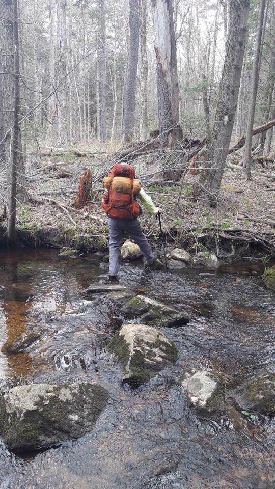
RockHopping

Rock hopping.

SharingaView

Appreciating a view.

Crossing the Mass Pike.

IMG_0371

We bought hard boiled eggs from the “cookie lady.”  Soho’s philosophy was moderate miles.  Good sleep.  Fresh food.  I learned to like it.

CampingatCookieLady

Camping at the cookie lady’s.  Looks warm, but it was 40F.

On the way to Dalton for a shower and resupply.

After Dalton we faced a pending storm that eventually dumped 1.5 inches of rain on the trail, turning it into an endless series of streams and mud pits.

Knowing what was coming, we pushed past Cheshire, Mass. to the Mark Noepel shelter where we planned to ride out the rain high and dry, less than a full day from the Vermont border.  The hike into Upper Goose Pond had taught us a lesson.

IMG_0404

The Massachusetts shelters are mostly of the same design with a loft.  Up there, we were out of the wind and slightly warmer than if we’d stayed below.  The windows are plexiglass.

IMG_0401

We tucked into our sleeping bags to spend the day thankful we weren’t hiking in the cold and rainy weather.  We could see our breath.  Note the cookie lady’s eggs atop the orange and tan stuff sack.

Shot this while the wind was relatively still.

With three days of rain in the forecast Robin and I decided to exit.  She’s within sight of Vermont.  She only has a few miles in Vermont to finish this fall before she completes the AT.

fullsizeoutput_128f

We bid Soho farewell on Mt. Graylock, the tallest peak in Massachusetts. This gentle and genial soul hiked on into Vermont. We hiked to the bottom of the mountain because the road to the summit had not yet opened for the season.

fullsizeoutput_1290

Mt. Graylock. Massachusetts WWI memorial.

fullsizeoutput_1291

An inch-and-a-half of rain produces boot top mud.

IMG_0406.JPG

The Graylock summit was windy, wet and bitter cold. I looked down only to spy trout lilies whose flowers had not yet bloomed.  A day later Soho phoned to say that the thermometer and snow in Vermont were forcing her off the trail.  Without doubt we had found the edge of spring; and on that edge the cold wind sliced through our hearts and blew us in new directions.  Our journey had ended.

Sisu


Short Part of a Long Journey

IMG_0247

Appalachian Trail, New York, April 2017 — Last week I was lucky enough to spend a few days hiking with my delightful friend Robin.  She is on a month-long trek to both close an unfinished gap she has between Georgia and Maine; and to get into shape for ridgerunning.

She parked her truck and stashed her extra gear at our house and then together we drove to New York where climbed up to the ridge that hosts the AT at the NJ/NY border on a very warm spring day.

IMG_0260

I met Robin, aka Miss America, when I was ridgerunning in Georgia in 2015.  The daughter of National Park Service rangers in the Great Smoky Mountains National Park, she’s a willy woodsman and a strong hiker.  She was a ridgerunner in Maryland last year and will serve in Northern Virginia this season.  All told, she’s a perfect hiking partner.

Speaking of what’s hot, I can’t remember the last time I hiked in temperatures under 80 degrees F.  Last September in Vermont, this March in Georgia and last week in New York it was hotter than Hades.  My socks have been so sweat-soaked that they make a squishy sound that squeaks like Crocks on a wet tile floor.  Talk about holding your feet to the fire.  Enough with the hot weather already!

Fortunately the water sources were plentiful and flowing.  In spite of that, I drank four liters of water and still didn’t urinate.  By the end of my journey, my clothes were so salt encrusted that they could stand by themselves unaided – you know, kind of crunchy like saltine crackers.

New York is the state where the AT angles a hard north eastern turn toward Maine.  The trail turns perpendicular to the north-south flowing ridge lines meaning it’s all day up and down for the hikers.  In other words, PUDS – pointless ups and downs.

Here rebar replaces an aluminum extension ladder that was too easy to steal.  Hey, it’s New York!

IMG_0276

The terrain is ugly for the most part.  This is hard work even when heat is turned down.

The gnats had recently hatched.  In NY they’re a feature, not a bug.

fullsizeoutput_103c

Can you spell rugged?

IMG_0270

How ’bout them bears?  We properly hung our food every night.

IMG_0290

Casualty.

IMG_0265

We navigate using a guidebook that lists terrain features, elevation profile, campsites, springs and also has town maps and phone numbers.

IMG_0261

Miss America photo bomb!

We were out four days before it was my time to head home for chainsaw recertification, a trip to Annapolis Rocks to bring supplies up to Gene Anderson and the Appalachian Trail Conservancy Flip Flop Festival this weekend where I’m a featured speaker.

IMG_0288

We tented rather than sleep in shelters.  This is at dawn, packing up before a big rain pending.  At first, Robin was worried about wearing a Red Sox cap in Yankee country, but people treated her as a novelty.  Not sure most of them had never seen a Sox fan before.

IMG_0287

Staying clean in the woods is critical to remaining healthy and avoid gastrointestinal ailments.  We were hiking along one afternoon when I got a message from the ATC asking me if I could take a photo of a hiker using soap and water to clean up in the field practicing leave No Trace principles.  We magically produced the goods.

IMG_0252

Hudson River Valley just south of West Point.

IMG_1373

Yes, the trail goes straight up that rock slab.

IMG_0279

Earning my trail legs.

IMG_0274

Sometimes you get surprised by trail magic.  This was just north of the aptly named “agony ridge.”  The sodas were cold too!  As a practice, leaving unattended food, trash and drink along the trail is not a good idea.  Too many opportunities to unintentionally feed animals and make a mess.  Some call this “trail tragic.”  We did appreciate it though.

IMG_0269

Old sign.  Can’t wait to rejoin Robin next week.  We’ll be hiking north until just before ridgerunner training starts in late May.  Then my spousal unit will come pick us up. There’s no doubt in my mind that Miss America will go far.

Sisu

Spring Cleaning.

fullsizeoutput_fac

Appalachian Trail Maryland, April 2017 — It’s April on the AT and spring is when it all starts to happen around here.  First up is ridgerunner kick-off. Our long-season ridgerunner/Annapolis Rock caretaker in Maryland starts on April 1.  I often wonder whether or not any of them figure out how auspicious that day is by the October 31 end of their very long term.  I’ve just never seen one sign up for a second long-season tour, so I suspect they pick up on the hidden meaning.

Last year you may recall Kyle MacKay was our lucky pick to spend seven months in the woods.  I mean, that’s longer than the average 2,200-mile thru hike. Blog post about Kyle’s first day.

This year the duty falls on Gene Anderson.  Gene is a genial former thru hiker from Carolina who spent his career in the insurance adjusting industry.  Now that’s seems like excellent preparation for educating hikers who need to repair their behavior.  Everyone of us has scratches and dents that need attention.

I met Gene early on April 1 at the U.S. 40 AT trail head, just up the hill from Green Briar State Park.  We went to meet the Maryland Park Service rangers he’d be working with and to collect his radio and other equipment.  After that, we moved his gear into the small apartment he’ll share with Kyle who’ll be on the clock for the short season from Memorial Day through Labor Day.

It took two trips to schlep all the gear up to the caretaker’s site.  Since I paid attention to how the tent was pitched last year, the dome was up and secure in short order.

Since the week-long formal ridgerunner training doesn’t start until May, the early bird gets OJT.  This year I spent four days with Gene rather than the two I spent with Kyle last season.  As luck would have it, we saw just about one of everything there is to see minus a major medical event.

I set my tent up behind the caretakers tent in close proximity to very recent bear activity.  Bears shred logs in very specific patterns.

IMG_0210

The claw marks leave no doubt.

I walked Gene around Annapolis Rock checking each campsite.  I showed him how to  “knock down” the privy “cone.” and where to find the wood chips users need to add as bulking material to aid the composting process.

IMG_0208The state felled 80 hazard trees over the winter making the area appear to be a no man’s land.  Two years ago a rotten tree fell and killed a hiker at another shelter in Maryland.  The response was to drop every possible tree than might come down in a high wind or in icy conditions.  The result:  Ugly, but safe.  As the trees decompose, the bears and birds are gonna love it.

IMG_0209

No fires are permitted at Annapolis Rock.  Alcohol isn’t allowed either.  Period.  Signs are everywhere.  Yet … people think the rules are for others.  We destroyed three fire rings like this one that had been created over the winter.  Later, we hit the mother lode when we caught five college students on spring break from Ohio with a fire.  Yes!!!  “Out damn fire!  Out!!!”  We let them keep their beer if they didn’t drink it.  Wink, wink.  Believe it or not, they were up and out by dawn.  My guess was that they would have been in a stupor at that hour.

IMG_0226

Part of the orientation is a tour of the rock.  I showed Gene how to get to the bottom of the cliff and a quick and safe way back up.

The second night, two scout troop leaders stopped by the caretaker tent to ask if their troop could build a fire.  We explained the rules and why they exist.  Fires can be built at Pogo campground, 30 minutes north or at Pine Knob shelter, 30 minutes south, just not at the rock due to environmental sensitivity.  “Well,” they said.  “There’s a roaring fire just off the AT 150 yards north of the AT-Annapolis Rock trail junction.”  Since neither fires nor camping is permitted in Maryland except in designated areas, we decided to check it out.

IMG_0218  I grabbed my headlamp.  It was black dark.  Sure enough we easily found a roaring fire about 25 yards off the trail.  There they were, three 50 somethings from Baltimore standing around an out of control fire in a high wind.  We asked them to put it out and explained where they could go if they wanted a fire.

The surprise was their age.  Usually the perps are between 20 and 40, young and immature men.  These were 50 + immature men….

The next morning we went back to check the area.  We found a set of tent poles and no sign of camping, so it appeared to us that they abandoned the site in the night and hiked to a place to where they could build a fire.  Unfortunately the fire was still hot.  Moreover, it had  been  built on duff (the dead leaf layer) rather than bare ground.  Luckily the area was saturated by recent rain.  Otherwise … how do you spell forest fire?

IMG_0220  IMG_0222

We hiked five gallons of water from the Annapolis Rock spring to douse the fire – and put it out, cold.  Then we covered and camouflaged it to help prevent a permanent “stealth” campsite from forming.

IMG_0216

We found a small blowdown which Gene cleared.

Gene also is a ridgerunner who patrols the trail in Maryland in addition to his duties as Annapolis Rock caretaker.  So off we went to inspect other sites.

IMG_0231

I love the stone chairs around one of the fire pits at the Pogo campsite.

At Pine Knob I showed Gene how to inspect the area and where to find the trash.  Women could not walk 50 feet to the privy.  Not sure why this happens, but it happens everywhere.

Enough of the dark side.

One of the best part of being a PATC ridgerunner is leading hikes for the Road Scholar program. Road Scholar We play a role in their hike on the AT in four states offering.

IMG_0223

People do the weird things.

Sisu

A flat soufflé and limp noodles…

IMG_0076

Good ole white blaze serial number 00000001

North Georgia, Appalachian Trail miles zero through 69.6, March 3-10, 2017 — There I was, hiking the Appalachian Trail in Georgia for the third year in a row.  This time it was different, very different, but we will get to that in due course.

This adventure started with an invitation to present my talk on trail hygiene at the annual ATKO – Appalachian Trail Kick Off event at Amicalola Falls State Park. The kick off targets future hikers and serves as a reunion of sorts for many others.

The premise for the talk is that hikers neither have to get sick – Noro virus or gastroenteritis – nor smell like Oscar the Grouch’s trash can on a hot summer’s day.  All they have to do is make staying clean a priority. My talk tells them how.

My talk is entitled “What the Funk!” I blogged about the subject here: What the Funk!  My Power Point slides are here:  https://www.dropbox.com/s/zwxxfhmz96vhn42/What%20The%20Funk.2.pptx?dl=0

The ATKO is a well attended two-and-a-half day event featuring speakers, vendors and old friends like Mike Wingeart and Robin Hobbs who were representing ALDHA, the Appalachian Long Distance Hiking Association.

The ATKO featured a tent city, gear vendors and even a slew of visiting owls.  This is a great horned owl.  His pals included a tiny screech owl named Goliath and a barred owl which remained amazingly quiet.  Trail Dames is a women’s hiking organization I try and promote as often as possible.  Love those gals, most of whom I’ve met on my various trail journeys.  Check out Trail Dames here:  Trail Dames

Now, let’s get down to business.  We’ll open with a brief confession.  I did not come to the trail with “trail legs.”  In other words, I was not in shape.  My excuse:  I injured my hip lifting weights in early October and have not run since then.  Throughout the hike, my hip and cardio were fine, but my legs had all the strength and authority of limp spaghetti noodles.  That’s definitely not a recipe for a fluffy soufflé in the nasty hills of Georgia. (Lovin’ mixed metaphors!)

The anointed know that launching from the Amicalola Lodge nets the upper five miles of the infamously steep “approach trail” that leads to the AT’s southern terminus on Springer Mountain.  I did it three years ago when I  had to spell the caretaker on Springer Mountain.  That year my gazelle-like bounds magically crushed the steepest hills.  This year I huffed and puffed like the little engine that barely could. I was delighted to summit, albeit about 90 minutes slower than before.

While on Springer, I took a look around.  I was saddened to see that two trees I’ve been tracking for the past three years had finally been done in.  The number of people on the trail continues to increase along with their relentless degradation of the environment.

IMG_0079

A bit hard to see, but campers have moved south of the lower bear cables on Springer Mountain shelter and much closer to the water source; and have established a new fire pit.

The good news is that previous recommendations have been implemented.  The increased presence on the trail has remarkably reduced trash.  Vegetation recovery projects have begun.  Extra campsites and privies have been added.  My observations from that time are here:  Georgia 2015

Old fire pit at Hawk Mountain shelter cleaned up.

IMG_0094.jpg

Improvements since last year to the new Hawk Mountain campsite.

As always the newly minted hikers were delightful.  I saw Lynne, the Trail Ambassador on the right, twice on my journey as she expanded her patrol coverage.  I saw several other ambassadors too.

Ambition has never been lacking for me.  Since this was my very first time to hike Georgia alone, I decided to pace myself in accordance with the legend in my own mind, versus the reality of my current physical condition.  Mind over matter was a good strategy, or so I thought.  That worked about as well as one might expect.

After pitching my tent the first night and on my way to fetch water, I met a young man who asked me if it was okay for his dog to be off leash.  Never ask a Leave No Trace zealot that question.  I convinced him that every snake, skunk, raccoon and porcupine in the woods would eat his dog for lunch, not to mention any stray bears.  How ’bout them Lyme disease bearing ticks ole fido is going to bring back to your tent?  Oh boy!!!

This fellow also decided to cowboy camp that night (no tent).  Guess what, it rained unexpectedly.  I awoke to his thrashing as he hurried to pitch is tent while dodging rain spatter.  “Grasshopper, you’re going to learn a lot,” I smiled as a hiked past his tent in the morning. He was sawing zzzzzzs.

IMG_0113

I have finally perfected pitching and striking this tent in high wind.  I failed at that miserably in Maine last summer. Hint:  Up-wind pegs first…

The plan for Monday was to make it about 15 miles either to the Justus Mt. campsite or on to Gooch Gap.  The forecast included rain and high winds for Tuesday, so I wanted to get as far as possible.

Moving with the speed to cold flowing molasses helped me realize that I wasn’t going to make either of my targeted locations, so I parked at Cooper Gap where, this year, the Army has been leaving its 500 gallon “water buffalo” unlocked for hikers. Now I was a half day behind with a cold, heavy rain in the forecast.

Very good news:  ALL water sources in Georgia were flowing with the exception of the spring at Blue Mountain shelter which is just short of Unicoi Gap.

Fortunately the heavenly watering of the Georgia hills didn’t begin until after I’d packed up.  I sopped off with a dry tent at least, headed for the Woods Hole shelter half way up the infamous Blood Mountain; about another 15 miles away.  Woods Hole has a covered picnic table and is located where bear proof food containers are required.  The odds were good that I’d get a spot, and I’d be back on schedule given that very few people want to carry the 3 1/2 extra pounds the canisters weigh.

Along the way, sometimes you see weird stuff.  Who would set the stump on fire at Gooch Mountain?  Just past there, somebody used a machete to hack up a dead tree.  For what?  The dead tree bark is good insect habitat for birds and bears.  Why ruin it?  Ignorance lives.

Please pack out your trash!  The fire pits and the trail in general was far cleaner than I’ve ever seen it at this time of year.  Thank you ridgerunners and trail ambassadors!

IMG_0140

I arrived at Woods Hole just prior to dusk.  I ate and then crashed between these two tents.

The morning dawned cold and windy.  The rain had passed. Of the three campers at Woods Hole, nobody had a bear canister. Surprise, surprise, surprise!  Where’s the ranger when you need ’em.

A father and son had pitched their tent in the shelter.  They were were woefully underprepared with summer sleeping bags and sported wet cotton clothes from the previous day’s rain.  The other tent belonged to a new thru hiker who didn’t know better.  I made it clear.  If more hikers came during the night, the tents would have to come down.  Fortunately, none did.

IMG_0142

It dawned cold and clear as I waited form my coffee water to boil. Note the two hats. After breakfast I was off for Low Gap, another 15 miles or so away.

Walking over Blood Mountain has its aesthetic pleasures.

Wind at Neel’s Gap

The trail to Low Gap is a relatively easy hike with the exception of a nasty climb at Tesnatee Gap.  My right hip flexor was swelling.  Time for a reality check.

Dawn at Low Gap.  Fortunately, from there it’s an easy 10 miles to Uniqoi Gap where I decided to bail.  The noodles were still limp and the soufflé was pretty flat.  Reached Unicoi about 12:30 p.m. and shuttled to the Top of Georgia Hostel.

IMG_0177.jpg

Bought a thru hiker lunch.  How do you spell bankruptcy?

Breakfast at Top of Georgia where Bob Gabrielsen offers the morning pep talk before the hopeful sea of humanity rides the tide northward in search of adventure and the state of Maine.  Time for me to saddle up the Subaru and ride north.

IMG_0178

Toxic waste bag.

It ain’t over until everything’s cleaned up.

Sisu

Walking the Line

img_5393

Appalachian Trail in Northern Virginia, November 9 -12, 2016 — While it is self evident that the Appalachian Trail itself requires frequent maintenance.  After all, an estimated three million hikers tread on some part of it annually.  That’s a lot of wear and tear.

What few hikers may realize is that the trail itself is one thing.  The land through which it flows is another.  That land can be federal, state, or local.  In some cases it belongs to private conservation groups or other entities.  All of those land parcels have borders, borders that are surveyed and marked.  They must be checked from time to time to ensure the markers are still there and no encroachment or other illegal activity is underway.

img_5422

Checking the AT corridor boundary is what I’ve been doing in northern Virginia for the past several days.  I was on a corridor monitoring trip organized by the Appalachian Long Distance Hikers Association (ALDHA).  Over time 30 some folks dove in, some for the whole time; others for a day or two.  Together we were able to check and remark several miles of boundary.

The boundary has no trail.  Crews edge their way along the border, bushwhacking through thickets and briars.

img_5447

Sometimes monitors have to get down into the weeds to find the survey monuments.

Once a monument is found, it is recorded and the brush is lopped away.

img_5405

Witness trees get refreshed.

img_5437

The boundary is marked in mustard yellow.  The paint, from bottles, is squeezed on brushes toothpaste style.  Bottles are refreshed daily.

img_5421

Sometimes monuments can only be found using the surveyor’s measurements.

img_5418

Brush trimming is not as fun as it appears to be. 🙂

The threats to trail lands and by extension to hikers are real.  People dump trash, extend their fences, or hunt illegally on these lands.

Who knows what led to this tragic scene.

img_5428

One thing for certain.  The former residents were unhappy with the government as other graffiti attested.

Later we decided to bushwhack our way to the AT for an easier hike out.  I found an illegal trail built by a hunter the previous year as noted in this blog post about my hike with ridgerunner Hal Evans. Vegetable Territory  The hunter had put up an illegal deer stand which was supposed to have been removed. Of special interest, it faced the hiking trail which was less than 100 yards away. This was an intolerable situation regardless of other circumstances.

img_5434

Note the odd-colored green paint the hunter used to blaze his trail.  The bottom part of the ladder was removed.  Standard procedure.

img_5453

img_5463

img_5469

Our intrepid crew cut the bicycle lock with bolt cutters and carried out the offending tree stand.  Some disassembly was required before it would fit into the ATC’s van for disposal.  The Appalachian Trail is a national park and a note and business card from the park’s chief ranger was substituted on the tree to account for the missing stand.  In a sign of the times, monitors were concerned that face recognition software might identify them to a revengeful hunter, so faces are not visible.

img_5440

The ATC crew has a van donated by Toyota.


We stayed at the Potomac Appalachian Trail Club’s Blackburn Trail Center.  It features three bunk rooms and a large commercial kitchen.  It is rentable for group events and weddings.  Otherwise it is used by trail crews, ridgerunners and others working on the trail.

img_5392

img_5394

Accommodations are rustic.  The plumbing is outside.

img_5445

Blackburn features a hiker cabin, tent pads and a covered eating area.

img_5442

Unfortunately the solar shower wasn’t working this late into autumn.

Gorgeous stone work at Blackburn.

Sisu

Moonlight in Vermont

IMG_0311

2014

Coming attractions:  It’s time to get back in the saddle, so what’s next?  The oldest hiking trail in the United States beckons. Next up, the mountains of Vermont and The Long Trail.

We’ll be driving to the Canadian border just as soon as the Labor Day traffic clears.  Then we’ll hit the trail early the next morning for what is hoped to be a 16 day trek – more if mother nature proves our planning wrong. The objective is to collect the 172 Long Trail miles missed when hiking the Appalachian Trail.  (Note: Sources differ on the exact distances involved.)

IMG_0370

The sign marking “Maine Junction.”

The AT and the Long Trail overlap for the 100 miles starting at the Vermont/Massachusetts border northward to “Maine Junction” just north of the Rutland and Killington area. At Maine Junction the trail hangs a sharp easterly right turn toward Hanover, NH and from there onward to central Maine.

The Long Trail was conceived in 1910 and stitches Canada to Massachusetts for 272 miles along the spine of Vermont’s rugged Green Mountains.  It’s rugged and last month’s 100-mile wilderness hike was good practice, but this adventure will be more strenuous.

IMG_0323

Ironically, both the Long Trail and Appalachian Trail were conceived in the same place.

IMG_0324

The fire tower on Stratton Mountain has been preserved and maintained so that hikers may see the same views that conceptualized the two hiking trails birthed there.

The hike has a happy ending.  Can’t wait!

My partner will be Rush Williamson, a fellow PATC member who also is highly involved in protecting and preserving the AT.  He’s also a retired Marine with whom I work closely on many trail-related projects.

For more on the Green Mountain Club and The Long Trail click on: Green Mountain Club and The Long Trail

Victory Lap of Sorts

IMG_4713

100-mile Wilderness, Maine, August 1-10, 2016 — Bottom line:  Eye witness accounts are notoriously unreliable.  I remembered the last 100 miles of my thru hike as a piece of cake.  In my memory, only the second day was challenging.  Oh Grasshopper, you definitely mis-remembered that experience!

Absent the adrenaline of a thru hike, the 100-mile Wilderness was hard work, and was it ever.  Nevertheless, it was a joy to share it with Windy (Pepsi Hiker) Horn and watch her face brighten with excitement as the wonders of this gem of a hike revealed themselves like a sultry fan dancer hungry for tips.  If Katahdin is the cherry on top, the wilderness is definitely the whipped cream and definitely worth the effort.

IMG_2195I met Wendy and her hiking partner Diane near Port Clinton, PA in 2014 on my thru hike.  We hiked together for several days before I eventually outran them and they had to return home to northern Illinois.  We kept in touch.

This summer I shared dinner with Wendy and her friend Rene at the Skyland resort in Shenandoah National Park.  Mostly we talked about hiking.

Turned out that Wendy has section hiked West Virginia, Maryland and Pennsylvania.  Nice, but little to write home about.  I suggested she chew off a chunk of excitement for motivation.  That’s how we found ourselves tramping our way through the ultimate 100 miles of Maine.

I drove to Maine to visit an old friend for a couple of days before snagging Wendy at the Manchester, NH airport.  We then motored six-plus hours north to Millinocket and stayed at the AT Lodge before being shuttled to Monson, the gateway to the 100-mile Wilderness.  There we stayed at Shaw’s, now under new and enthusiastic ownership.  The place was packed to overflowing.

IMG_4704

The first stop was the Appalachian Trail Conservancy’s new visitor center in Monson.  The number of AT hikers is overwhelming Baxter State Park and Mt. Katahdin.  A new permit system is being tested that will ultimately meter in a finite number of hikers per day and limit the allowable number coming from the AT to 3,000 hikers per annum.

We will save the arguments about the efficacy of this system for another time.

At Shaw’s we arranged a resupply drop which, sadly has upped in price from $25 to $80.  Seems hikers were dumping their garbage in and around the old 5-gallon paint buckets. Worse, some food was being stolen.  Now, resupply is delivered to your hand.  It takes some doing, but it worked okay for us except that it cost an unanticipated $40 each.  At least we could split the $80 cost.

THE DROUGHT

Maine suffered a dry winter.  This weather pattern has continued into summer.  In spite of the drought, the ponds have plenty of water to keep the outlet streams running.  The tertiary streams and many springs are bone dry. Hikers need to plan their water carefully.  The water sources for two Lean-tos were bone dry.

Same spot, two years apart.  The soil is thin with only inches of soil having been created since the glaciers retreated.  It doesn’t take much for a rain shower to make mud, or the sun to just as rapidly dry it out for that matter.

Desiccation is everywhere.  Even the blueberries are raisins.  If the berries fail, the bears, deer and other animals which depend on them will suffer.  The harsh reality is that some will starve.

The forest is tinder dry and we learned that fire crews have been propositioning equipment in expectation of forest fires that most certainly will occur.

Here’s a graphic example of the drought’s effects.  Little Wilson Falls, two years apart.

IMG_4907IMG_1047

Crossing Little Wilson Creek, two years apart.  This is not a crossing I ever imagined would be feet dry.

THE TRAIL

The trail begins gently enough with some gentle climbs and slab walks.

IMG_4764

Plenty of roots, considered a trail feature in Maine.

IMG_4797

Got rocks?  We climbed this twice … How?  The trail was rerouted at some point to include this gem.  The old trail wasn’t blocked and we accidentally did a two hour loop.  Ugh!

Not exactly a sprint.

THE JOURNEY

Ya got yer stream crossings and yer views.

We planned for an eight-day transit, allowing for some short and some long days dependent on the terrain.  The weather opened windless, humid and hot.  Temps were in the 80s and 90s which is cooking for Maine.

IMG_4799

Normally, I drink one to two liters per day and another in camp.  The first day I got dehydrated because several water sources were dry.  I filled up my spare three liter bladder (six lbs.) which we shared.  Problem solved.

Two years ago, I didn’t encounter more than a dozen or so hikers.  This year there were dozens upon dozens.  The college students told us that hiking is now a campus fad.  Good to get new blood into the woods, but the trash level was much higher than before.

IMG_4781

Two students from Elon U.  They had a general idea of what to do, but little knowledge of Leave No Trace outdoor ethics and practices or the fact that privies aren’t everywhere you can camp, or how to properly wash dishes in the woods (not in the pond), or the finer techniques of hanging a food bag.   I pulled out my handy Leave No Trace card and led a discussion in the proper practices.

IMG_4778

Only one place to get water from the pond where we camped the first night.  Guess what’s under that artsy reflection of the sky?

IMG_4780

Some Bozo washed his dishes at the only place campers can get water.  Brilliant.  Not!

IMG_4901

A snowshoe hare mowed the shelter lawn.  His hind feet were huge and mostly white.

As it turned out, I overestimated how much mileage we could make.  The terrain was tougher than I remembered and the heat was oppressive.  Each of us was fit enough, but …

IMG_4801

Wendy twisted her knee about 40 percent of the way in and had to be “med-evaced” (shuttled) back to Monson for a recuperation day.  Here she’s arranging transportation.  She brought our resupply when we rendezvoused at Jo-Mary Road – along with a surprise: An icy cold Coke which I appreciated very much!

Nature’s art gallery.

IMG_4865

Laundry.

IMG_4906

Katahdin in the distance.

While Wendy recuperated, I hiked over White Cap Mountain in the cold rain – exactly the same conditions and time of day as two years ago.  It wasn’t a happy flash back.

I pushed on to Cooper Brook Lean-to the next day to swim – almost as good as a shower.  The next morning Wendy rejoined at Jo-Mary Road and we were off.

The AT has its moments.  One that sneaks up on you like a woman in a Philip Marlow novel with that come hither smile then sets you up for a hard fall is the newly reopened White House Landing.  I missed this one last time around.  They pick you up in a boat and stuff your face full of burgers and incredible homemade pizza.  You don’t leave hungry in the morning either!  It helped that the weather broke to cool temps, low humidity and a nice breeze.  So much for wilderness.  Perfect!

IMG_4850

This little guy stood his ground.  No rattles, but with the body type of a pit viper including the narrow neck and triangular head.  Definitely not a hog nose.  Possibly a water snake.  We were near a river.

IMG_4877

The 100-mile wilderness ends at Abol Bridge, just before entering Baxter State Park for the Katahdin climb.  There were about 20 hikers headed for Baxter where there’s only room for 12 long distance hikers.  Everything else is reserved car camping.  We shuttled into Millinocket and drove into Baxter because we didn’t want to occupy space.

Katahdin is awesome!

IMG_4885

Made it!  Second time around is not the same, but it’s still pretty good.

New sign this year.

IMG_4873IMG_4874

Pretty obvious.

More trash than we could carry out.  This is just a sample.

IMG_4841

Best sign of the trip.

Sisu.


What the funk?

IMG_2749

I was out on my annual walk with some of the Potomac Appalachian Trail Club ridgerunners last week.

On this particular walk I started asking about thru hikers about their previous hiking experience.  Better than 90 percent said that they had little to no previous backpacking experience before toeing off on Springer Mtn.  Admittedly it’s a small sample.  Nevertheless, the answer to this question and other observations got me noodling about hiker hygiene …

In central Virginia I called someone to shuttle me into town for a resupply. I tossed my pack into the back of the van; then jumped in. The driver reflexively rolled down her window even before I could get my door shut.

I knew what she was thinking. “This guy’s a thru hiker and I bet he smells to high heaven.” She knew I’d been on the trail for five days and her expectations were reasonable. Hell, when I’m out maintaining my AT section, if the wind is blowing just so, I can smell the thru hikers long before they come into view.

Anyway, as she pulled away, I implored my benefactor.

“You don’t have to do that. I don’t smell.” She looked me in the eye, wrinkled her nose and said, “You’re right.” “How do you do that?” she asked as she returned her window to the upright and locked position.

The answer is simple.   Personal hygiene is priority for me and a point of pride. I also don’t want to “smell like a Boy Scout” as my mother used to say to my brother and I when we returned from our camping trips. More importantly, I don’t want to get sick. It’s another level of Leave No Trace if you want to see it that way.

IMG_4566

My personal hygiene kit. It clips to and hangs with my bear bag at night.  It’s the equivalent of snivel gear for me.

Hikers don’t have to stink if they don’t want to.  I may may take it further than most, but staying clean isn’t all that hard and it has many benefits.  Experienced hikers tend to be the cleaner ones.

IMG_4567

The contents include tooth brush and paste, Dr. Bronner’s soap, waterless shampoo and waterless body wash, large microfiber wash cloths which double as towels, deodorant and Q-tips.  Fingernail clippers usually reside in my pocket for quick fingernail cleaning.

Here are eight hiker hygiene considerations.

IMG_4568

  1.  You don’t have to stink.  Using waterless shampoo and body wash each night is the trick. It’s a nice complement to the tick check, the weight is negligible, and it has the added benefit of helping to keep your sleeping bag from smelling like a dead gym sock.  Rub it in and wipe it off with a microfiber cloth.  You can buy the stuff and any drug store or REI.  Hand sanitizer works as deodorant if you rub it in, but I carry the real stuff.
  2. Bury your shit!
    Not only is it an unsightly and smelly disease vector, but the Bible itself, Deuteronomy 23:13, says do it!  Deuteronomy 23:13
  3. Wash your hands. I allocate two wet wipes per day for use when I relieve myself.  I work from the top down, face first, pits followed by the business at hand.  When done, they’re returned to the foil container they came in; then on to the trash bag. No monkey butt!  I also use a dab of Dr. Bronner’s eco-friendly soap to wash my hands whenever I get water.  I wash away from the source in a zip lock I carry for that purpose. I clean my fingernails each time I wash my hands.
  4. Treat or filter your water.  I prefer iodine and the neutralizer pills to save weight and space, but I also have a Sawyer.  The method is not important.  The key is to make it a habit.  Better safe than sorry.
  5. Dental care.  Brush after breakfast and again after dinner.  The key is the brushing action.  You don’t need but a dab of toothpaste which you can either swallow or spit into the woods away from camp.
  6. Clean your dishes!  This thru hiker was as filthy as her dishes.  I cook only foods I can rehydrate in Zip Lock freezer bags or their original containers.  If you cook in your pot, clean thoroughly with Dr. Bronner’s and scatter the gray water far away from camp.  You can dig a sump and strain out any chunks with grass or vegetation.  The chunks need to be packed out.
  7. Lyme disease.  This is bad stuff.  The most dangerous animal on the AT is the tick. Permethrin kills them on contact. You can have your clothes professionally treated here: Insect Shield or purchase permethrin spray at any Walmart, outdoor store or REI.  They even have it at the AT Conservancy Visitor Center.  I go overboard.  I spray my pack, the inside of my sleeping bag and tent and wear permethrin-treated long pants.  For those who don’t like chemicals, weigh the risk.
  8. Noro Virus.  The aforementioned practices can do a lot to reduce your chances of catching this ugly bug.  If you have a good relationship with your physician, you can get prescriptions that will stop vomiting dead in the water and doxycycline you can take on a prophylactic basis if a tick chomps you.  Imodium stops diarrhea.  I carry them in my first aid kit.  So far, so good, but it’s a comfort to know that they are there.  I had to promise that I’d immediately see a doctor if I took any of the prescribed meds.

Stay well.  Smell good.  Enjoy your hike!

Oh! The things we see.

IMG_4495

Pine Grove Furnace State Park, PA to Harpers Ferry, WV, June 30 – July 6,, 2016 — My annual hikes with our ridgerunners have begun.  This year my muffin top needs shrinking so I decided to walk all 240 miles of the PATC section in hopes of burning some of it off.  I’d like to do it nonstop, but schedules, theirs and mine, dictate otherwise.

13627098_10209856576756529_2414766433861332628_n

After dropping my car at the Harpers Ferry National Park long term parking, Robin Hobbs schlepped me up to meet Mitch Mitchell at the store where hikers traditionally eat a half gallon of ice cream to celebrate reaching the halfway point which is just down the trail.  From here the math for them changes from counting up the miles to counting them down.

Prospective ridgerunners think the job is about hiking.  Readers of this blog know from last year in Georgia and other missives that the opposite is true.  It mostly about picking up trash, coaching hikers in Leave No Trace outdoor ethics, counting and interacting with hikers.  The miles per day are generally slow and short.

This trip was no different, but here’s fair warning.  I’m going to let you in on some ridgerunner reality show secrets and it’s gonna get gross…

We were also out over the July 4th holiday weekend, meaning more people in general, more nubes, and the laggard thru hiker party crowd which is not known for its trail decorum.  In fact, they openly admit to yellow blazing (hitch hiking) and to using booze and drugs in excess.

The rule of thumb is that if a hiker isn’t at Harpers Ferry by the Fourth of July, they need to “flip” to Maine and hike south or risk winter weather shutting them out of Mt. Katahdin in October.  These folks are walking on the bleeding edge of that axiom.

IMG_4493

Selfie at the official half way marker.

Our start was leisurely enough.  We got about a half gallon (by volume) worth of trash out of the fire pit at Toms Run shelter and pressed on.  Before the day’s end Mitch’s pack reminded me of a colonial tinker plying his trade along the rutted byways that traced the very region we were trekking.

As we moved along, trash of all kinds accumulated.

IMG_4498

I don’t know what it is with me and finding pots and pans.  Since hiking with Hal and Lauralee last year, I’ve found enough to open my own store.

IMG_4499

Any more trash and he won’t have a place to put it.  It’s the second pair of new (cheap) boots I’ve found this year alone.

IMG_4509

Taking inventory before feeding the friendly dumpster at New Caledonia State Park, PA.  We’re not showing you the snack bar just out of the photo.  I packed out some of their tasty treats for  dinner for that night.

Homeless camp on state park property.  It was a family that appeared to have left in a hurry.  Some toys and a pink blanket were in one of the tents along with clothing.  The food in the cooler was rotten.  The park rangers cleaned it up.  Too big for us to haul out on our backs.

After spending the night at Birch Run shelter with a noisy crowd of hikers, we press on.

Ridgerunners see a lot of gross stuff on the trail including unburied human waste, used feminine hygiene products,  wipes and toilet paper (Charmin blossoms) and the like.  We fish it out of privies, pick it up and pack it out or bury it as appropriate.  What comes next  is a first for me.  Why I was surprised, I don’t know.

You’d think after more than 1,000 miles on the trail, hikers would learn a thing or three, especially about hygiene.  Maybe not.  We found the young woman who owns this food dish improperly camped too close to a stream and illegally camped in the vicinity of a PATC rental cabin.  I’d met her previously while hiking with Denise the week prior in Virginia.  The embedded dirt on her skin reminded me of a character made up to be in a movie about peasants in the middle ages.  My stinky gym socks smell better.  Small wonder hikers get sick on the trail.

There were fewer flies on this pile of human scat I buried than on our hiker’s food plate.  These videos will go into every presentation I will ever give from now forward on backpacking.

Approaching Deer Lick shelter, we bumped into a PATC trail crew hiking out their tools.  They were nice enough to invite us to dinner with the North Chapter group, so we grabbed some of their tools and Chris Ferme’s chainsaw and tagged along for some chicken pot pie, green salad and fresh backed blueberry and lemon pie for dessert.  Yum!  Chris hauled us back to the trail in time to reach Deer Lick before dark.  The next day we hiked over their handiwork.  Nice job guys!

The following morning Mitch dropped off to participate in a PATC North Chapter hiker feed back at Pine Grove Furnace.  I pushed on to Raven Rock shelter in Maryland to rendezvous with Robin.

People love to steal this sign.  I was lucky it was there this trip.

Removed a small blowdown obstructing the trail using a folding saw.

IMG_4527

Evidence of the party crowd.  Scattered the sticks.

IMG_4506

The last of the rhododendron blooms.

IMG_4530

Bear activity has been unusually high this season.  The good news is that most hikers have found religion when it comes to bears and are hanging their food and toiletries rather than sleeping with them.  Yogi and Boo Boo have been working overtime.  Bears have entered shelters and stolen packs in search of food and destroyed tents.  Shenandoah has closed a section to camping and bear sightings in the PATC’s 240 mile section have been frequent.

While at Raven Rock shelter, MD, Robin and I hiked down to the old Devil’s Race Course shelter location (now torn down) and dismantled the fire ring.  That will help make it less inviting for high school drinking parties that caused the new shelter to be built up a steep hill from there.

Now, it didn’t happen by accident that I timed my hike to be at Annapolis Rock for July Fourth ’cause guess what?  You can see fireworks from that lofty perch.  Unfortunately the rain was falling in buckets with heavy fog.  We saw zip, but the campground was nearly full in spite of the forecast.

IMG_4533

The clouds were clearing the next morning when I set off for Crampton Gap after a quick photo op with Robin.  It was Kyle’s day off (the other Maryland ridgerunner), but I’ve been out with him before and we intercepted him along the way.  He’ll be there through Oct. 31, so we’ve got plenty of time.

The AT foot bridge over I-70.

IMG_4543

The original Washington Monument outside Boonsboro, MD.  My camera lens was foggy with sweat!

IMG_4544

C&O Canal lock # 33 just outside Harpers Ferry.  I’m standing on the tow path.

IMG_4501

Back to Virginia and Shenandoah soon.  Sisu

Weedwhacking

IMG_4423

A ray of light perfectly aligned with my eyes under my hammock fly this morning at 6 a.m.

Shenandoah National Park, June 17-19, 2016 — It was North District Hoodlums trail crew work weekend.  I usually go to the park on Friday early to work on the section of the Appalachian Trail for which I am overseer and personally responsible.  Saturday we do crew work.  Sunday we clean up any odds and ends we didn’t get done on our AT sections.

It’s been raining like crazy on the east coast for the past month. In fact, it’s only recently warmed up.  Add water to vegetation and you get jungle!  Jungle is habitat for the ticks that are the vector for Lyme Disease.  What to do about that. The only logical thing is to chop back the jungle.

IMG_4404

Weed whacker Man – a superhero if there ever wasn’t one.

I spent two whole days week whacking.  First was my trail.  Second was a section that belonged to a dear fellow who left us for the charms of Milwaukee.  Did I mention that it was hot?  At least there were two of us the second day – we are a crew, right?

IMG_4406

The idea is to cut the salad back about double arms length from the center of the treadway.  The hikers should not touch vegetation as they walk.  No vegetation.  No ticks (well, almost).

I have an informal campsite on my section.  No fires allowed people.  They build them anyway and risk the fine.  I break up the fire rings by tossing the rocks a long way away.  This knucklehead obviously had an unsuccessful fire, not to mention ample signs of raging diarrhea.  Poetic justice.  Damn right.  I’m sparing you the shxtty pics, but I always document the scene of the crime.

The third week of June is prime thru hiker season.  Time for the annual Hoodlums hiker feed.  We cooked burgers and hot dawgs for about 30 thru hikers.  Turns out that they were all very nice folks.  That’s not always the case this late into the season.

IMG_4411

Sometimes we see dramatic views.  Worth a whack so to speak.

Love the evening ambiance.

Next up:  I’m about to hike 55 miles through northern Virginia with Denise, the friend with whom I hiked Georgia.  She’s here and off the trail on “vacation.”  After that, I’ll be out for 240 miles with this year’s group of excellent ridgerunners.  Can’t wait to get moving!